Showing posts with label N5294W. Show all posts

12 December 2015

Flight for Football

N5294W - C172R - 1.7 hours

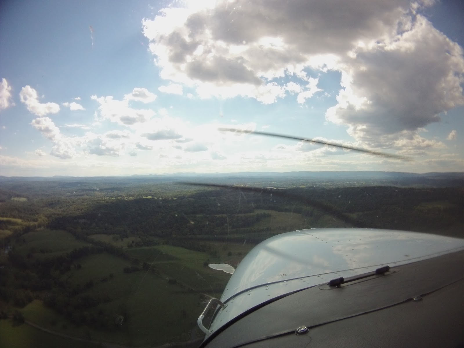
Since this blog is about flying, I tend to keep references to my personal life to an absolute minimum. In this case, though, I'll make an exception to give the flight some context. My stepdad is the coach of the football team at the high school I went to years ago, and they made it all the way to the state championship this year. Since it was down in Charlottesville - and you know how much I love Charlottesville (CHO) - I figured I'd try and get a flight in. In order to log some instrument time, I invited my friend Woody (of Dodging Traffic fame) to come along, too.

I think I have finally hit my limit on flight narratives for Charlottesville, so I'll keep it short:
  • We flew down. I logged instrument time.
  • The game went into triple overtime. My stepdad's team won.
  • We flew home. I logged more instrument time.
For being December, it was unseasonably warm, which also made the flight pretty pleasant. Today was a good day.


Hours:
Pilot in Command Cross Country (PIC XC): 1.7 - 128.8 (of 50)
Actual/Simulated Instrument (Act/Sim): 1.2 - 31.9 (of 40)
Dual Complex: 0.0 - 7.7 (of 10)
Total Time in Aircraft: 1.7 - 197.5 (of 250)

09 September 2012

More Comfort Food in Charlottesville

N5294W - C172R - 1.7 hours

Clouds west of JYO
The other night, I was hanging out with my friends Christina and Brittany and the idea of flying this weekend came up.  No plans were set in stone, so when the idea came back up I was somewhat surprised.  At first, since the flight would be between lunch and dinner, I figured we'd just fly down to Luray (W45) and back.  As the time came to head up to the airport, I changed my mind and decided and Charlottesville (CHO) because I needed food, and you all know what my go-to is by now.  Just like last time, the plan was to head to Timberwood Grill.  I've been there all too much over the past year, so I'm going to go on the record and say that trips to CHO are going to be drastically reduced for a little while.  I feel like I'm missing out on a lot of other destinations.

Sorry Timberwood - I still love you.

On to the narrative.

After getting to the airport, Christina, Brittany and I grabbed the flight book and headsets, and walked out to the plane in weather that I'd consider to be just about perfect.  After the preflight, they both climbed in the back while I set up my Garmin GLO GPS (which I just got in the mail on Thursday - I'll review it with ForeFlight eventually), ContourGPS, and the rest the technology.

The taxi out took a longer amount of time than normal because the nice weather brought everyone out.  Whereas there are normally only one or two people ahead of me, I ended up heaving two departures and two arrivals ahead of me by the time I finished my engine run up.  Once they had all done their thing, I was able to get up and out.  I got a video of the departure, but it was just downright ugly with the wind that had picked up so I didn't upload it.  This being Brittany's second flight ever - not just in small planes - the bumps weren't appreciated.  Reaching cruise, though, the bumps smoothed out.

Yes, this is the big EMB-145
Getting closer to CHO, I called the tower and was instructed to call back when I reached the downwind for Runway 3.  As I entered the downwind, a Piedmont (regional carrier for US Airways) Dash 8 called in and was cleared to land ahead of me.  I turned in behind it, landed, caught the first exit and brought it in to the Landmark ramp.  I had the Contour running the whole flight, but I didn't upload any of it because nothing truly interesting happened (and I'll admit the landing wasn't the best, either).  After parking, an American Eagle (regional carrier for American) Embraer 145 taxied out to the runway, prompting Brittany to comment that "it's so BIG!"

As usual, I was greeted with "you gonna want the crew car?"  As much as I like being recognized, this is more evidence that I need a break from CHO.  In an effort to break the norm in some way, I actually switched it up at dinner and got an Al Capone burger.

ForeFlight running with a Garmin GLO
and iPod on the aux input
On the way back, I spent a little more time testing ForeFlight, while we listened to my iPod through the aux cable I bought a while back.  For those who are wondering how that works since pilots need to listen for other pilots and air traffic control, the aux input is overridden any time someone speaks, either in the aircraft or over the frequency.  That ends up making listening to music frustrating at times, but it's worth it for longer flights, especially at night.  Having GPS input on ForeFlight really makes it that much more worth it, as well.  Now, every plane I fly essentially has a moving map GPS.  Granted, I can't shoot approaches with it, but it really helps.

As we got closer to Leesburg, the bumps picked back up as a result of the wind having increased and the lower altitude.  The JYO traffic frequency was really busy with one in the pattern, a MedFlight helicopter inbound, and two other aircraft approaching from the north.  The two approaching from the north had apparently gotten really close to each other, and there was an interesting exchange between the pilots that clogged up the frequency for a while.  I compensated by making my calls really short, but I still ended up getting stepped on a couple times by the other pilots.  Despite all of the radio traffic, I managed to get in during a break in the traffic.

You'd think that it was easy from then on, but it wasn't.  The wind really messed with me, with gusts making it difficult to hold a proper speed down to the runway (which you can definitely see in the graph to the right of the video below).

Enjoy said video of me getting my butt kicked all the way down final:

[Video was here until Contour closed down for a bit, and the video was lost.]

Didn't expect that greaser of a landing at the end, did you?

Hours:
Pilot in Command Cross Country (PIC XC): 1.7 - 66.8 (of 50)
Actual/Simulated Instrument (Act/Sim): 0.0 - 7.5 (of 40)

20 August 2012

Storms Can Be Nice

N5294W - C172R - 1.7 hours

Short final on last year's flight
There are very few things in the world that I would prefer to do more than flying, so when it comes to what I do on my birthday, an airplane is likely involved at some point.  Last year, my friend Jason and I flew down to Bridgewater (VBW) and ended up catching a glimpse of a B-17.  This year, I took the day off from work in order to relax and fly.  My friend Ashley managed to leave work a little early as well so that we could fly and be back in time for a dinner out with some more of our friends.  Unfortunately, the weather didn't have the same plans.  Fortunately, a little patience, good company, and a nice pilot lounge ended up working out.


After we arrived at Leesburg (JYO), we grabbed the keys for the plane and walked out to preflight.  One of the instructors had just gotten back in and gave us a weather update that there were storms over the ridge heading towards us.  Ashley and I had been checking the weather all morning, mostly because the ceilings had been so low the last couple days, but I was definitely aware that the weekend's second front was passing through.

We continued on to the plane to check it while watching the weather.  The guy said there was a storm, and I believed him, but a lot can be said for actually seeing the weather.  I figured we could at least get our stuff situated in the plane while keeping an eye on the sky.  Unfortunately, as can be seen in aviation lore and AOPA magazines all over the place, pilots make bonehead moves and press on despite weather issues.  Because I kept walking towards the plane after the instructor had warned me of the storm, I'm guessing he got the feeling I was going to try to beat it, so he walked out, iPad in hand, to show me the latest radar images (the center + is IAD, with JYO's + slightly northwest of it):


What he hadn't seen was the fact that I did actually check the weather, and that the radar loop was still running on my phone, so his concern was understandable.  It's nice to see that we'll look out for each other, but there's a sad side to that coin as well: despite all of our training and warnings of "get-there-itis," pilots still give other pilots reason to express their words of caution.  I told him my plan was to preflight, watch the weather, and set things up so that as soon as the front passed, we could go.  That seemed to restore some of his faith in me, and before he walked back inside we talked some about his iPad's ForeFlight setup.

After we had set up out headsets, my camera, and everything else, the wind picked up and the the rain arrived.  Ashley and I retreated to the pilot lounge and watched TV while the storm blew over.  I also kept an eye on the weather using ForeFlight's radar overlay and looking out the window.  As soon as it passed, though, we walked back out to the plane to give it one more look and set off towards Charlottesville (CHO).

The departure was standard, and as soon as I could, I put the blinders on to log some simulated instrument time.  Over Upperville (2VG2), I called Potomac to get flight following, and give Ashley a feel for who to call and when.  Before I put the blinders on, I got to see some of the coolest clouds I've seen to date in the low areas and valleys.  They're not as obvious in the picture here, but you can see them in the video.  Ashley took this picture about half way down to CHO, and you can see the clouds almost seem to be resting right on top of the trees.  Storms can be violent, but the clouds and smooth air that were left behind were really nice.

As soon as I got handed off to CHOWE (the radar controller serving CHO), I asked for a practice ILS approach to Runway 3.  It had been immediately rejected, but I thought I heard "roger" so I waited to hear back.  A new controller stepped in soon after, and after I reported to him that I had the weather information at CHO, I asked again about the approach.  This controller came back with a slightly longer answer of "Not approved - can't do opposite direction anymore after DCA screwed it up the other week" (referring to the incident at DCA on 31 July).  Since I couldn't try the ILS to Runway 3, I asked for the RNAV GPS Y to Runway 21, which was approved.  You can see the tail end of the approach here in the video:

[Video was here until Contour closed down for a bit, and the video was lost.]

The whole approach can be seen in the time lapse video at the end of the post.

After landing and shutting down, I brought Ashley to Timberwood for what was originally going to be dessert or something light, but the delay put us more in the dinner mood, so we got burgers instead.  After dinner and the drive back, we were back up in the air to head home.

The flight back was pretty peaceful, and I got more simulated instrument time.  Since it was getting dark, and not being able to see terrain is unsettling, I took the blinders off to have extra eyes looking to make sure we were headed in the right direction.  Adding to the tense setting, I managed to forget to stop by the rest room before departing CHO.  Luckily it wasn't bumpy.  You know the rest.


Hours:
Pilot in Command Cross Country (PIC XC): 1.7 - 65.1 (of 50)
Actual/Simulated Instrument (Act/Sim): 0.9 - 7.5 (of 40)

07 June 2012

A Stormy First

N5294W - C172R - 1.7 hours

Earlier this week, Ashley asked if I wanted to go flying soon.  Of course, I'm always up for a flight and we both had time tonight, so I set us up with a plane for some flight maneuvers and perhaps an approach.  Her friend Greg also joined us to get a feel for flying the smaller stuff.  As far as flights in small planes go, this would be his first.  Unfortunately, throughout the week, the forecast had a decent chance of storms in the evening.  Leaving work, I could definitely see some convection that could get in the way, but summer storms are spotty and I know there are a good number of airports locally should we need to get down quickly.


While Ashley and Greg were caught in traffic, I got the plane all set up, and then relaxed in the shade under the wing for a few minutes.  Once they got there, Ashley ran through her own checks of things, explaining them to Greg.


I-66 below and 522 in the distance
After we all got situated, we departed to the west so that we could fly around the practice area (out by Winchester, VA).  On the way out, I took advantage of the fact that there was another pilot on board and got some hood time until we got out there.  Once there, Ashley took over to get some time at the controls to brush up on turns around a point and s-turns.  After a few attempts, hindered by the wind of a storm a few miles to the northeast of us, I was given the controls again for some hood work.  Ashley called out directions and I followed them to the best of my ability.


Of course, even though I checked to make sure the camera started the recording, it apparently died before I plugged it in after starting the plane, so I caught the few moments up to starting the engine and that was it.  The hood work, rainbow and lightning all went unrecorded.  Unfortunately, all of these issues were brought on by myself.  I never charged it after using it last, figuring I had enough time left to run it until I had a chance to plug it in.  Oh well.  Greg caught the rainbow with the still camera, so all wasn't lost.


In the end, Ashley directed me closer and closer to Winchester (OKV), where she could practice a few landings.  Since it had just rained and the runway was recently grooved, it was actually pretty cool looking.  The last few feet on either side didn't have grooves, so the rain made that part shiny, while the middle appeared perfectly dry.  After a couple trips around the pattern, I was handed the controls again and took us north towards the Martinsburg VOR (MRB).  Even though I didn't have my charts, my ForeFlight trial had expired, and I didn't want to look the chart up on my phone, I was still able to fly the approach by pulling it up in the KLN-94 GPS.  As opposed to the last logged approach, this one was a lot better.  We'll see how it looks next time.

I'm still trying to get over the fact that I need the same amount of time that it took to get my private pilot license under the hood for my instrument rating.  At least this flight took a full hour out of that total.

Hours:
Pilot in Command Cross Country (PIC XC): 0.0 - 56.3 (of 50)
Actual/Simulated Instrument (Act/Sim): 1.0 - 6.6 (of 40)

25 May 2012

Solo to the West

N5294W - C172R - 1.6 hours

At first, my old college roommate and I were supposed to head up to State College (UNV) on Wednesday so I could head out to a new place and get some hood time.  That ended up getting scrapped because the weather was less than ideal.  Then, on Friday, I was supposed to head out with Ashley on a flight similar to our flight a month ago, but her job got in the way.  Life and weather both happen, so you work the hand you were dealt.  The tease of flying got under my skin though, so I was going flying with or without someone else in the right seat.

Similar to my last flight, I had a couple destinations in mind.  To the west, I picked out Grant County (W99) because it's a quick trip and it's surrounded by mountains.  To the east, I picked out Bay Bridge (W29) because it's through the VFR Corridor, which is a challenge, and it's right out on the Chesapeake Bay.  In the end I picked W99 because I really didn't want to bother with a flight plan, or the SFRA.

Note the odd trend of laziness when I don't have people to fly with.  Oh well.  As long as I'm doing what I need to do to stay safe, I'm allowed to pick destinations based on how little effort they require if it's only for myself.

What haze?
I had left my sun glasses in the plane last flight.  Thanks to the staff they were sitting in the book when I grabbed it out of the lock box.  Nothing at all interesting happened on the way out.  The weather, however, wasn't the most optimal, with a little haze when facing the sun.  After passing north of Upperville (2VG2), I called Potomac Approach for flight following, which continued with Washington Center all the way out to W99.


Similar to Bedford County (HMZ), W99 is buried in the mountains.  Unlike HMZ though, it doesn't have any mountains on short final.  According to the Airport/Facility Directory (A/FD), there's a fly-in campground on the field somewhere, but I didn't see it.  Sounds like it could be a fun outing if I ever figure it out.  After taxiing back, I made a short and soft field takeoff to keep it interesting, as usual.

On the way back, I let Washington Center deal with its business without having to look after me since the frequency sounded busier.  I monitored the frequency all the way back to Strasburg to listen in for traffic, however.  Strasburg is where the grandparents live, so as I passed over, I descended to about 1000' above ground level (AGL), circled once, and then climbed back up and continued on to JYO.

Closer in to JYO, I set myself up for an approach to Runway 17, landed, taxied off and shut down.  Hopefully next time will be more exciting.  W99 is a cool airport, but it's less interesting to me when there's nobody to share it with.


Hours:
Pilot in Command Cross Country (PIC XC): 1.6 - 56.3 (of 50)
Actual/Simulated Instrument (Act/Sim): 0.0 - 5.6 (of 40)

14 April 2012

Friday the 13th

N5294W - C172R - 2.8 hours

Apparently this weekend is beach weekend for just about everyone, and I got tired of reading everyone's Facebook updates on the matter, so I did something about it.  Using the same media they were using to celebrate the fact that they were going interesting places, I asked if anyone wanted to go to Ocean City for the evening.  Interestingly enough, an old friend from high school picked up on the offer with a "plus one," if you will.

We worked it out so that he'd get there at about 6:30, and we'd leave around 7.  As I walked into the terminal, I passed by a tall guy who looked a lot like Rick Santorum and thought to myself "hey, that guy looks a lot like Rick Santorum - poor guy must get that a lot."  I dismissed it and walked inside to file a flight plan and write down all the frequencies.  As I rounded the corner, I saw a familiar face from back when I lived out in Phoenix and worked at Deer Valley (DVT).  Turns out one of the flight instructors there, who now works the charter side, just flew Rick Santorum back from a conference in St.Louis.  We caught up for a few minutes and he showed me the plane quickly, but they were off for one more leg to Teterboro (TEB).  Crazy.  Unfortunately, as we'd all find out in a few minutes, none of us were going anywhere anytime soon.

Joe and crew waiting patiently
As I was preflighting and waiting for fuel, Matt and Z both got situated in the plane.  At some point in there, Joe taxied by for the flight up to TEB.  Soon thereafter, as I was getting myself situated, I saw a guy pushing a Cessna on the runway.  Getting out for a closer look, the guy was trying pretty hard to get the plane off of the runway, so Matt and I both ran down there to try and help out, joking that our high school track days are long gone.  The plane had a flat on the left main, so it wasn't going anywhere.  We tried to pull it farther off into the grass, but the airport officials said it wasn't far enough and closed the airport until it was moved.

Killing time
Luckily, the Landmark crew brought a tug out to pull it back to their hangar to take care of it.  As we were waiting, there was very little for us to do, so the pilot of the plane started taking pictures of the plane, and I started taking pictures of the sunset.  I'm sure the people sitting in the run-up area were less than pleased that we weren't doing anything productive, but there was really nothing we could do.  In the end, I think there were four or five aircraft in the run-up before the airport reopened and aircraft could depart.

As soon as the Cessna was past the hold line and clear of the runway, I went back to our plane to get us out of there.  Unfortunately, by this time it was already about 8, which is very clear in the video.  I had it running in HD 1080 this time, not that it looks any better since the low light means it's not picking up much.  The high resolution also killed the battery at about 45 minutes in.  To avoid that in the future, while still capturing high def, I ordered a power adapter.  Here's the takeoff, though:


[Video was here, and then Contour went bankrupt for a bit, so it got lost.]


The flight out started off somewhat oddly, as I couldn't turn eastbound until Potomac TRACON observed my transponder (note the terminology), so that I could proceed through the SFRA and the VFR Corridor that I flew through back in August.  I talked to MULRR (126.1) first, then WOOLY (128.7) and BWIFS (119.7).  While with WOOLY, I got to listen in to the controller handling two flights into Fort Meade (FME).  He pointed them both out to me, and then handed me off to BWIFS where I was alerted to three more targets over the Chesapeake Bay.  Two of them passed under me in an uncomfortable way.  I'm really not sure what they were doing, but they seemed to have gone into Annapolis (ANP).  I wish the video picked it up, but it didn't (though it did pick up my opinions of the pilots, muted somewhat by the sound of the engine).

OC Oceanfront at the Inlet
As soon as I cleared the Bravo and climbed a little, I passed the controls to Matt so he could fly some.  Potomac handed us off to Patuxent Approach, and we stayed with them all the way out to Ocean City.  Closer in to Ocean City, I took the controls and brought us out over the city so Matt and Z could get some pictures of the shoreline. Nearing the boardwalk, I attempted to bring us in to Runway 32, but I was so high I needed to circle back around.  That did the trick, and after landing we taxied back to a dark, motionless ramp.

Walking out, we grabbed a Ford Expedition that was left for us and headed off to the boardwalk.  There, we grabbed some pizza and ice cream before stopping by another friend's place up on 89th Street.  Since we needed to have the plane back, we didn't stay too long and made the trek back to the airport around 11ish.

Back in the air I called Washington Center for flight following, but the controller had me wait and let him know when I was passing 4000'.  At first I was confused as to why, but then I remembered it probably had something to do with the radar not picking up aircraft below that altitude (the area is normally covered by Patuxent, using a different radar site, but they had closed for the night).  Later on with Potomac, I managed to get a clearance through the Bravo all the way back to Leesburg.

FlightAware track for the flight home
Once I had Leesburg in sight, the controller dumped me to CTAF for the landing.  You know the routine from there.

Hours:
Pilot in Command Cross Country (PIC XC): 2.8 - 53.2 (of 50)
Actual/Simulated Instrument (Act/Sim): 0.0 - 5.6 (of 40)

19 September 2011

Turning into a Charlottesville Regular

N5294W - C172R - 1.6 hours

Over the course of the years, I've had people ask if I could take them somewhere by plane.  Some people want to go somewhere specific, while others just want the experience of being off the ground in something other than an airliner.

Back when I had just gotten my license, I told my friend Kim I'd take her up sometime, and I partially came through on that a few years ago when I went to get checked out in a 172 out of Winchester (OKV).  The flight was only an hour, and an instructor was in the front seat, so it wasn't anything too incredibly interesting.  In an effort to follow through, and find an excuse to go flying, Kim and I set off to Charlottesville (CHO) for dinner at the ever-so-awesome Timberwood Grill.

Departing JYO
Things started off well, though it's been getting cooler this week.  As I explained to Kim how to conduct a thorough preflight, a couple jets departed - a Gulfstream and a Lear - along with a MedStar chopper.  Like my last flight, the clouds were somewhat low, so I stayed lower than I normally do for cross country flights, but nothing too bothersome.  As we got closer, static in the radio and our altitude kept me from picking up the ATIS as early as I'd like, but I did manage to monitor the tower well enough to determine I should stay off of the runway centerline.  CHO's runway is pretty well aligned with the path I take to get down there, which is nice when they're landing to the south, as you just land straight in.  When landing to the north, however, you have traffic climbing right at you, which is why I like to pick up the ATIS early so I know which way departures are headed.

As I came in, there were two departures to the north, and an airline departure that had to wait on a release for departure, so tower assigned it Runway 21 (a south departure).  We were assigned Runway 3 (landing to the north), which I found odd, but I didn't question it.  The airline departure had to wait, either for me, or for the release time, but just in case it was me, I tried to keep my pattern tight and taxi off as soon as I could. Surprisingly, despite the rush, the landing was pretty smooth.

Northwest of Madison, VA
We actually made it down to CHO relatively quickly, compared to the flights over the summer.  The cooler air helps the engine perform a little better, so we made it down in 0.8 hours (the plane shows time out to tenths of an hour, not minutes, so it was somewhere between 42-48min).  After shutting down, we walked inside to grab the crew car, which had already been taken.  When you have it, you're supposed to have it back within two hours, and the guy had been gone for a little while, so we figured the wait wouldn't be too long.

After a while of waiting, the guy wasn't back despite the time limit, so I called a briefer to file a flight plan and check the weather again.  Rain was coming in from the west, which only added to the reasons to head out earlier rather than later, and off we went.

As we walked out to the plane to head home, a SAAB 340 taxied out and departed, which reminded me of my old job, and how much I miss working around aircraft all day.  Then again, it also reminded me of several things I definitely don't miss about that job.  Oh well.  They had to deal with TSA and terminals while I walked right out.

The flight back went off without an issue.  It was dark and getting colder, but it was calm, smooth and peaceful.

Hours:
Pilot in Command Cross Country (PIC XC): 1.6 - 31.8 (of 50)
Actual/Simulated Instrument (Act/Sim): 0 - 3.9 (of 40)

22 August 2011

Back to Luray

N5294W - C172R - 1.7 hours

Note for other pilots:
The airport identifier for Luray is now LUA. Of course, everything hasn't transitioned to LUA, so W45 may still be needed in some cases. Flight Service mentioned it in the brief before the flight.

This flight came somewhat out of a random connection made at work, thanks to another one of the instructors (of the co-worker, non-CFI variety), and a need to test an aircraft out before I took it through a potentially dangerous corridor of airspace (more on this in a later post). Long story short, I met another pilot at work - Ashley - and we decided to take a flight so that I could test this plane, and she could get a feel for the local airspace as she's new to the area.

Since I just wanted to make a quick flight, I decided I'd head back to Luray. It's a short flight, but I can at least use the hours towards the cross country requirement of the instrument rating. After the preflight, a call to the FSS to file the flight plan, a second preflight by Ashley, and a few questions, we were off. The second preflight and the questions were things I fully expected, but I was also forewarned by her as it's her own safety thing. As a CFI, you experience a wide variety of students, many of whom often remind you that you need to always keep an eye on them. Since she is a CFI and hadn't flown with me before, the second preflight, and the questions were understandable.

To be honest, the questions also opened my eyes a bit to things some pilots take for granted. I began flying in this area, so terrain and airspace awareness are a huge thing to me, but I take it as it comes. To someone who began flying in flatter areas, the terrain can be unnerving. The same can be said for those whose first sectional had very little controlled airspace depicted, arriving in this area, where some of the airspace is very controlled, and even further, very prohibited. The questions about what I do to cross a mountain in the daytime versus the night were questions I hadn't consciously considered fully, much less many of the other questions. It's a good example of how to learn from someone else, really.

On the flight down, I explained some quick ground references that can help in remaining below the Dulles airspace, pointed out some prominent landmarks, and ended up getting 0.1 hours of hood time (it's not much, but every bit helps meet the 40 hour requirement). The approach to Luray was slightly off, as I turned too close to the field, so I ended up going around. After going around, we landed with a decent crosswind, taxied in, turned around and were back off. I ended up using the same cut over to New Market, up I-81 as I used before in order to buy time to talk to the FSS to refile a flight plan back in to Leesburg.

The route back brought with it some great shots of the sunset, and some familiarization with the airspace out in the Shenandoah valley. Along with it, though, came the dark of night and a slightly nervous CFI because not seeing the ground becomes an issue in the case of an emergency. As she put it, "if the engine fails, we're on a wing and a prayer." It's very true, but it's something you have to accept somewhat if you want to fly around here. This area is full of hills and trees, that are in most parts unlit. Other than not flying at night, there's not much you can do about it. Flying brings with it the risk of somehow no longer getting the option of flying. Managing that risk is still an issue, and one we'll continue to argue as long as we have wings.

Hours:
Pilot in Command Cross Country (PIC XC): 1.7 - 25.3 (of 50)
Actual/Simulated Instrument (Act/Sim): 0.1 - 3.6 (of 40)