N944DB - P28R - 5.0 hours
While I've been planning multiple variations for my long instrument cross country for some time, I never actually got around to flying it. Usually, it came down to an issue where I had other plans for flying, and that meant that there wasn't enough left in the month's flying budget for the longer flight in addition to the extra cost of having a CFI in the right seat. About a month ago, though, I was checking my progress against the requirements of the instrument rating and commercial pilot certificate and noticed that I'm getting rather close to both (as such, those who have read earlier posts here will notice the new additions to the hours section at the end of this post). Given my tendency to plan things out in great detail, I began to plan out the time between now and commercial minimums.
 |
| Aforementioned Simulated Aircraft |
As one could probably tell, given my lack of updating this blog despite having flown a decent amount, flying the same aircraft that I've been flying for 12 years has been wearing on me. It's not that flying itself is getting boring; it's that one of my jobs allows me to fly simulations of some rather complex aircraft, and in comparison, a Cessna seems rather dull. Luckily, to satisfy my need for something different, the commercial requirements require 10 hours in a complex aircraft, and the school I rent from has an Archer to fit that purpose. In order to get my instrument rating I also need more instrument time, so on top of the new aircraft and a route to satisfy the long instrument cross country, I figured I'd do a significant portion with the blinders on. So, apart from getting to experience something new, I'd be able to maximize my flight dollar by knocking off several requirements in one long flight.
In order to get as much time in the Arrow as I could, while still getting the instrument cross country done, I planned out a flight that somewhat followed the shape of Virginia. This would allow me to depart Leesburg (JYO) and fly a route that provided flexibility for the approaches I wanted to fly. As planned, the routes were KJYO CSN V286 CCV V1 ORF [VOR 23] KCPK - KCPK FKN V266 SBV V136 PIGGS [ILS 34] KROA - KROA MOL V143 HOAGE [RNAV 17] KJYO. I had figured that the initial VOR approach into Chesapeake (CPK) would get the VOR approach out of the way, but also allow for a circling approach at a relatively calm airport if needed (though the forecast showed the wind favoring Runway 23 anyway). After that, Roanoke (ROA) had an ILS, an LDA, and a few RNAV approaches that I could fly, which allowed me to fly the opposite approach - ILS or RNAV - at JYO.

After getting back from my earlier flight, I grabbed the book and checklist to go familiarize myself with the plane for about an hour before the flight. The flight school I had worked at back in 2009 had a fleet of Archers and a couple Arrows that had a similar layout, so it wasn't entirely unfamiliar even though I had never flown them. After coming to grips with where everything was and getting all of my accessories situated - kneeboard ready, blinders readily available, and iPad within reach - Tim met me at the plane and we set off toward CPK.
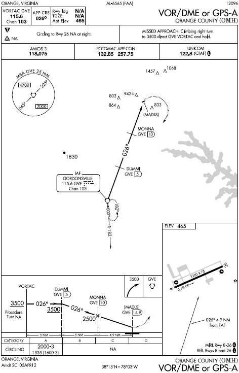
Potomac TRACON (PCT) cleared us via STILL CSN WAIKS, despite my well-intended filed route. We were cleared to CSN well before getting to the STILL intersection, and it was about that point that I began to see how sluggish the Arrow can be in the summer with full fuel and two people in it. Passing through 5000, PCT asked us if we could give them our best rate to 6000, which we acknowledged, and then joked to each other that we were essentially already giving it to them, despite it being rather paltry. Just prior to reaching CSN, we were given a vector to the southeast, and then direct to CPK. Closer to CPK, Norfolk TRACON sent us to the ORF VOR and cleared us for the approach.
The approach clearance came a little late, which resulted in needing to turn back toward the approach course, but that also allowed me to get rid of some extra altitude, so it wasn't unwelcome. The rest of the approach wasn't bad, and having Tim calling the altitudes and managing the radios made things a lot easier. After switching to the CPK common traffic advisory frequency (CTAF), we were somewhat surprised by the lack of traffic in the pattern as it was such a nice day. After taking the blinders off, I maneuvered for landing and brought the plane in. For my first landing in an Arrow, it wasn't terrible, but managing the heavier controls made things interesting.


After taxiing off the runway and back down to the runup area, we began to set up for the next leg of the flight. Unfortunately, we couldn't raise anyone on the clearance or approach frequencies for a clearance while still on the ground, so we planned on departing VFR and picking up our IFR clearance in the air. While we were on the ground hoping for a response from the controllers, I snapped a picture of the altimeter. I know I've flown to Ocean City (OXB) a few times, which is close to sea level, but I don't think I ever paid attention to how close to sea level the altimeter showed that we were. To me, seeing it so low was novel enough for a picture.
Soon after, we were airborne and flying the noise abatement departure procedure, as there are houses pretty close to the airport on the west side. Tim called for clearance while I maneuvered toward the FKN VOR to begin my planned route. Unlike with PCT earlier, Norfolk cleared us "as filed," which made things easier as I didn't have to write down a full route clearance and set a new flight plan into the GPS. Approaching Suffolk Airport (SFQ), we were vectored away from it in order to avoid parachute jumpers. Later on, after FKN, we were given direct ROA, with a vector around restricted airspace near Blackstone Army Air Field (BKT). Closer to Lynchburg (LYH), we were handed off to Roanoke TRACON, who noticed the remark on the flight plan requesting the ILS or RNAV approach, and were cleared for the ILS approach to Runway 34. I chased the localizer and glide slope more than I would have liked, but I ended up generally where I wanted to be when I took the blinders off, so all was not lost. The landing, too, wasn't too graceful, as I chopped the power a little early and the nose dropped some just prior to touching down.


After we taxied over to Landmark and shut down, Tim gave the line guy the fuel order and I snapped a picture of the plane and walked inside. By then we were pretty hungry, so we grabbed a crew car and set off in search of food, which ended up being Sonic right down the road. That trip turned into another trip as we'd been handed the wrong order and drove off without checking it. After scarfing food, joking a bit with the staff, and settling the fuel bill, we went back out to the plane to head home.
Tim, working the radios again, called for clearance. Like the initial clearance from JYO to CPK, this one was altered, but it was also altered to the point that the whole clearance was just a single fix, so it was a simple change. We were given Runway 34 for departure as well, which meant a relatively immediate turn after departure because of terrain. The Arrow climbed slowly through the now hotter air, though some updrafts off of the terrain assisted at times. The associated turbulence, however, wasn't as welcomed.
The leg home was rather uneventful. We flew right up the eastern side of the Shenandoah Valley, and as soon as we crossed over into the Piedmont we were sent up to the initial approach fix for the RNAV approach to Runway 17 at JYO. The approach went relatively well, but an intermittent GPS position issue knocked my vertical guidance out and I had not caught it. The result was that I was slightly below path for the latter part of the approach. For future approaches, I'll have to be more mindful of the flags. In order to mesh better with traffic in the area, we broke off the approach and circled around to land on Runway 35. This landing was better than the one at ROA, but it'll take me more time to get used to the Arrow.


Rolling out long, we jumped off on the taxiway that put us right near our parking spot, shut down, and put the plane away. Despite the sluggishness in the climb, the Arrow was an enjoyable departure from the norm. In the end, the flight was 5.0 hours, which means that I have another 5.0 hours in it to finish off the commercial requirement. Having knocked out the long instrument cross country, 3.9 combined actual/simulated instrument, and my biennial flight review (BFR), I'd consider it a success. Now all I need to do is rack up 12.8 more hours of instrument time and I can go take care of the instrument rating. Having that will really open up the possibilities for flying days to begin taking a closer aim at the commercial requirements. Along those lines, I need to finish the aforementioned 5.0 hours in a complex aircraft; fly a solo cross country trip with a leg length of greater than 250 nautical miles between JYO and some other airport, stopping at another airport on either the way out, or the way back; and finish up the remainder of the 69.3 hours between what I have now and the 250 hour minimum. So close, yet so far away.
Hours:
Pilot in Command Cross Country (PIC XC): 5.0 - 112.0 (of 50)
Actual/Simulated Instrument (Act/Sim): 3.9 - 27.2 (of 40)
Dual Complex: 5.0 - 5.0 (of 10)
Total Time in Aircraft: 5.0 - 180.7 (of 250)