26 December 2011

Cumberland for a Change

N172DR - C172R - 1.5 hours

When I asked if anyone wanted to join in on the flight a few days ago, a couple people showed some interest, so I figured I'd take another trip.  My friend Melissa asserted she's a pretty great passenger in a small plane, so I invited her along for the flight.  Initially, I sent her a link to a flight map website and said pick a spot, but aviation sectionals aren't the most understandable to someone who hasn't used them much, so the job of picking a destination fell back on me.

A few posts back, I mentioned a need to head out west for once, as I've rarely gone out in that direction.  More specifically, I was supposed to head out to Cumberland (CBE) a while back with another one of my friends, but we decided to head down to Charlottesville, as I knew what was there and that we could actually get around with relative ease.  I was still curious about Cumberland, though, so I figured I'd give it a shot.  It's a relatively short trip out west, it has some interesting terrain around it, and I don't head out west enough.

Regular Appointment with the DR
Since it was the day after Christmas, I was surprised to show up at the flight school and find the president and vice president of the flight school manning the counter.  I figured someone else would've drawn the short straw. In any case, I got the book, checked the weather, and then headed out to preflight and show Melissa how to properly shake down a plane.  I was the last one to have flown it, so everything was still relatively in order.

Just like the last flight, the wind was still pretty strong, though not unmanageable.  It made for a bumpy flight all the way out west, and even more so while we were stuck under Dulles' Class B airspace.  Once we cleared the Blue Ridge mountains, I was able to pop up a little higher, though just like last time, clouds kept me lower than I'd wanted.  A large break in the clouds allowed me to get up another thousand feet for a few minutes, but another line of clouds ahead of me forced me back down, and back into the bumpier air.

Soon enough, though, we were closer in to Cumberland, where I entered the pattern for runway 23, set down and taxied over to the terminal for a quick run into town.  At first, I figured we could just eat at the airport cafe, but as the attendant noted on the frequency and as a sign also pointed out on the door to the terminal, the airport cafe was closed indefinitely.  One of the guys at the airport recommended we check out the Crabby Pig, which is a local seafood/barbecue place.  Since we weren't going to be too long, they also let us borrow one of the airport trucks, which was nice of them.

The trip into town wasn't too bad, since they gave us a quick run down of how to get there, but the place is somewhat hidden, so we ended up parking a little farther down the road than I thought we would.  I got their pulled pork, to see if it could stand up as a barbecue joint.  I would've gotten seafood, but to be honest, in the likelihood that one would be better than the other, I figured it would have been the barbecue.  Don't get me wrong, we were technically in Maryland and we all know - crabcakes and football, that's what Maryland does - but this part of Maryland might as well be part of West Virginia (the airport is, actually).  The verdict?  I'll take it.  It could have been better, but it certainly wasn't bad, either.  The smoker was out back, so I know they smoke the pork right there.  The sauce could have been a little better though.  Wait, is this a flight blog or a food blog?  All of the pilot folk know about the (two) hundred dollar hamburger, so it's all related. I don't care what you think.  Either way it's worth another shot, and if you're there down there, I'd recommend it.

On the way back, I filled the truck back up as a thanks for borrowing it, and set off toward the airport.

Back in the plane, I got everything situated, started and set off for the runway.  The wind had died down significantly, so the departure was pretty smooth, in addition to the climb.  The clouds had all disappeared, too, so I was able to climb a little higher.  The way back was much shorter because of the wind aloft, which pushed us up to 140-145 knots across the ground (161-167 mph).  As we descended back under Dulles' airspace, it got a little bumpier, but not too bad.

Two Grass Strips and Summit Point
In the descent, I tuned into one of Potomac Approach's sectors for arrivals from the west (MANNE), where I got to hear an interesting conversation between the controller and an arriving flight.  The arriving flight was assigned the most inconvenient runway possible at Dulles.  Because of that, the pilot questioned it to make sure the controller didn't say it by mistake, to which the controller's response was simply that there was no misunderstanding between the two.  A few moments later, however, the controller came back with a more convenient runway.  From the privacy of my own flight deck, I commented aloud that thanks were in order, but as I said it, the pilot came back and thanked the controller.  I know a bunch of you reading this wouldn't find that nearly as funny as I did, and still do, and for that I almost apologize, but not quite.

Turning Final 35 JYO
Anyway, back on the ground, I put the plane back in its spot, reorganized everything and we headed home.

Hours:
Pilot in Command Cross Country (PIC XC): 1.5 - 43.4 (of 50)
Actual/Simulated Instrument (Act/Sim): 0 - 4.9 (of 40)

23 December 2011

Yes, Charlottesville Again

N172DR - C172R - 1.7 hours

The last time I flew with my buddy Phil was back in college.  That's way too long in my book, so we tried working out a flight over Thanksgiving, but that fell through.  Since he's back here for Christmas, I figured it would be a good time to finally get that flight in.

Originally, we were going to keep it to a shorter flight but since Phil's brother's fiancee lives down near Charlottesville, we ended up settling on that as the destination, and Phil's youngest brother James would also be joining us.

Phil on the preflight
At the outset, it was an interesting morning with higher winds and lower clouds, but neither would be problems for the departure.  The forecast said the clouds would lift some, but the wind would continue.  Here at Leesburg, it was straight down the runway, but the forecast at Charlottesville showed an increasing crosswind as the day progressed.  In any case, it wasn't too worrying and we met up in Leesburg to get everything set.

In the time between my last flight in October and this flight, the FAA changed procedures out of Leesburg where we no longer need to file a flight plan to fly in the Special Flight Rules Area (SFRA), which saves me a little time.  In the end, it really saves me the worry of forgetting to file.

Departure shot
When I first got back in the air back in July, my goal was to start to pick up better habits that I'd never really concentrated on in my private training.  Part of that was to always use the correct control positions for the wind during taxi, and I definitely used that taxiing around today.

The flight down was a little bumpy, made slightly worse by being kept low by clouds.  We talked to Potomac TRACON on the way down, and since Phil had requested a quick circle around his brother's fiancee's house, when Potomac dumped us on Charlottesville tower, we told them what was going on and that we'd give them a call when we were back inbound.

Circling the house, Phil and James got video and photos of their brother Francis and his fiancee Andrea running around the yard with one of the family dogs.  In the process, I was brushing up on turns around a point, with moderate success.  After a few laps, I called the tower to tell them we were back inbound, and he cleared us to land on runway 3 since we were the only traffic at that point.  As we got closer, though, a few departures had an opportunity to get out, so he extended our downwind and re-cleared us.

At the airport, we waited a few minutes for Andrea and Francis to show up.  They had apparently made the wrong turn and ended up at the terminal.  It's all the same at the small airports, right?  We figured it out though, after a quick walk from where we were over to the parking lot over by the terminal.  As ever, our destination from there was Timberwood, where I'd have an opportunity to change it up and get a Chuck Norris burger, instead of my usual Clint Eastwood.

Switching from ASPER to JYO CTAF
After paying for the fuel, Phil got the ATIS while I gave the plane a quick shakedown.  Ground got us out to the runway, and tower gave us the usual "climb on course, cleared for takeoff."  This time, however, there was more than the usual amount of traffic being called out.  A Cessna and a Colgan SAAB were both inbound to the field, coming from the north.  We ended up spotting the Cessna, but the SAAB was further out, and was well enough right of course that it wouldn't be a problem, so we switched over to Potomac and talked to them all the way back up to Leesburg.

Middleburg, VA
The landing was a little flat - as they almost always are with me - but I thought it was pretty good.  Phil got video of it (Phil also has video of one of my worst landings ever), so we'll see what that looks like when it's up.

I ended up getting 0.7 hours under the hood on the trip down and back, thanks to Phil also being a pilot, so there's some of the 40 down, though I still have a good bit left.  Hopefully, I'll get the long cross country with multiple approaches taken care of soon to wrap up the XC time, and burn some hood time.

Hours:
Pilot in Command Cross Country (PIC XC): 1.7 - 41.9 (of 50)
Actual/Simulated Instrument (Act/Sim): 0.7 - 4.9 (of 40)

23 October 2011

Charlottesville? Again?

N144ME - C172S - 1.6 hours

A few weeks ago, when I met up with my Washington Center (ZDC) controller friend, Julie, we decided she needed to get back up in the air.  At first, my plan was to meet a friend for breakfast, then run to the airport for a flight out to Luray or similar, and then run out to Strasburg to visit the grandparents.  Breakfast ran late, so I was late to the airport, and I had booked the plane later than I had thought, so I royally screwed up there.  After calling the grandparents, though, they decided that it was better to visit another weekend anyway, which freed up more time for a longer flight and a longer trip in general.

During the week, we were looking at several destinations, but the last two we were looking at were Luray (W45) and Cumberland (CBE).  Cumberland looks like a nice flight with some cool terrain around the airport, and I know Luray has a few things in town, but I wasn't sure about the availability of cars to get us around on a Sunday.  I did know, however, that my frequent flight spot Charlottesville would definitely have a car for me, so we headed in that direction.

Rolling on 17 JYO
The guy in N144ME before us got back a little early, but something happened to the software the school uses to track its aircraft, so that ended up negating an earlier departure.  In the end, I just grabbed the keys so that I could preflight while they worked out the computer issue.  Everything checked out with the plane and Julie managed to grab the book while I was finishing up, so we jumped in and taxied down to Runway 17 to head down to Charlottesville.

Final 21 CHO
On the way down, Julie got some time on the controls and called a few co-workers up in a few different sectors of ZDC.  The trip down was pretty smooth, but smooth means hazy, as the pilot folk reading this should already know.  I kept it high and fast coming in to Charlottesville to see if I could beat my time from the last flight.  I managed to make it in at 0.7 hours, tying the last flight.  As we walked in, I grabbed the crew car from Landmark to head into historic downtown for the first time in a long time, and grab food.

Charlottesville Historic Downtown
Driving towards downtown, I remembered why I hated the drive down to Charlottesville: stop lights, and an endless amount of them at that.  In any case, I managed to remember how to get downtown without too much of an issue, even though I hadn't been there in three years (not that it's too hard anyway).  I'd forgotten how short the walk is from end to end, but I missed the local feel of the whole thing.  We walked in a few stores to look at what they had, and ended up running in to Great Scott's Popcorn to get a snack.  I think I've only added butter, Old Bay, and maybe salt and pepper to popcorn, so the flavors they had there were quite the experience, and they were actually rather delicious.  Definitely worth a stop if you're down there.

Can you see the excitement?
When you have the crew car, you're only supposed to have it for two hours, max, so we made our way back towards the airport, stopping at Timberwood for lunch.  Our server, who I've had before but have forgotten her name again, made sure we were in and out and back to the airport with a little time to spare on the two hour mark.  It isn't that she's not memorable, it's that I'm horrible with names.  I guess I should work on that.

Unfortunately, when we got back, there was a crew waiting on the car.  We were definitely back within the two hour limit, but the guys seemed pretty irritated.  I can understand that to a certain degree, but relying on the crew car is luck of the draw.  I flew down to CHO and flew back without having ever left the FBO because someone took more than the two hours (Turning into a Charlottesville Regular has that story).  Stuff happens.  Even so, I still feel slightly bad, because some pilots get worked hard, and the last thing they want to do is sit in an FBO waiting on someone else to give them an escape.

Before we left, Julie, being a controller, was able to get us up in the tower last minute for a quick tour.  The controller there had been there forever, and had his quirks, but he also had cookies and a cool view of the airport.  We stayed up there for a few minutes and then decided to head back home while there was still a little daylight left.  On the way out we had to hold short for an inbound SAAB 340, but after they were off, we were off.  The trip back took just under an hour, and I got a few minutes of night PIC.  As an added bonus, Julie handled all the radio work and some of the flying until we got back closer to Leesburg.  I think the next time we head out, we'll have to hit somewhere northwest, or southeast.  Looking at my flight map, it's decidedly lacking in those two directions:


Hours:
Pilot in Command Cross Country (PIC XC): 1.6 - 40.2 (of 50)
Actual/Simulated Instrument (Act/Sim): 0 - 4.2 (of 40)

16 October 2011

Breakfast in Luray

N329ME - C172S - 1.4 hours

In an earlier post, I mentioned there were people I hadn't taken flying since getting my license.  Several of those people are in my own family.  While I've taken a few family members up - my grandma, my aunt and uncle, to name a few - none of my immediate family had been up with me until today.

A little while back, my dad proposed that my brother and I set up some activity for each month so that we actually see each other regularly.  What better to draw my attention than flying?

Originally, we'd planned on flying the day before, but it was supposed to be windy, so we delayed until today in hopes that it would be better.  I'd also planned on trying to get out earlier rather than later so that we could fit in an early lunch, or breakfast, and not get in the way of plans later in the day.  Luckily both of those worked out. It wasn't too windy and we were able to get out right on time to head down to Luray.


Front Royal - FRR
The departure was standard, with a little turbulence over the mountains.  On the way out, I pointed out Upperville (2VG2), Mount Weather, Front Royal (FRR), Skyline Drive, and a random assortment of other roads and landmarks.  The turbulence really didn't let up in the valley, but it didn't bother me too much.  Being a frequent flier of the commercial sort, it didn't bother my dad much either.


Final into Luray - W45
The approach into Luray ended up being a little high, so I ended up slipping the plane in during the approach.  I'm not sure how my dad had heard of that before, but when I mentioned what I was doing, he was familiar with it.  I also explained the whole "barn door" approach path indicator system and how it would let me know if I was high or low with about as much technology as smoke signals for communication, but it works, right?  The slip worked out well, and I ended up greasing in a nice landing on Runway 22.  Despite the nice landing, I ended up locking the wheels up slightly as the runway dips right after the touch down zone and we ended up getting airborne for a few feet.  Since I was braking and we lost contact with the ground, the wheels didn't have to work against the aircraft's weight and locked.  When we settled back on the runway the locked wheels took a second to catch back up.  In the end it wasn't a big deal, though it did catch me off guard.  In any case, I turned around and taxied back to the tie downs so that we could run into town for a few hours.

John, the airport attendant on the weekends, suggested a place called Uncle Bucks for breakfast.  Initially, I thought we'd just go back to Artisans Grill, but it was early enough that we could get breakfast.  Despite the wait, it was actually pretty good.  I had corned beef hash, and it was awesome.  I really can't remember what my dad ate, but my attention was taken by the amazingness of my own dish, to be honest.


After breakfast, we figured we'd walk around town before calling John to pick us back up, but the quick walk ended up being all the way back to the airport.  It was nice out, so why not?  The town is pretty small, and had some interesting small town sights.  On the outskirts of the town, we passed the entrance to Luray Caverns, and then continued past a petting zoo and corn maze back to the airport.  I still have yet to actually go into the caverns, though I've driven by them several times.

The flight back was uneventful.  I ended up filing a flight plan on my cell phone using DUATS, instead of bothering with Flight Service, on the phone or in the air.  Closer in to Leesburg, past Front Royal, the turbulence started to get worse, and my dad got to run his own mini-experiment with the altimeter, where he watched to see how much we actually "fell" when we dropped in turbulence.  It's really not that much, even though I explained that basic altimeters have some lag in their indication.  Unfortunately, when we made it back to Leesburg, I proved planes can fall quite quickly - onto the runway.  It wasn't a terrible landing, but compared to the nicer landing into Luray, it wasn't nearly as graceful.

I'll have to dream up an interesting destination for next time.

Hours:
Pilot in Command Cross Country (PIC XC): 1.4 - 38.6 (of 50)
Actual/Simulated Instrument (Act/Sim): 0 - 4.2 (of 40)

15 October 2011

They Just Hand Me the Keys Now

N329ME - C172S - 1.7 hours

Since my friend Jeanne is in town, she's been running all over Washington DC, exploring places I haven't been to in my entire life of living here.  One of the places she had yet to explore was the Udvar Hazy Center, which is an extension of the Smithsonian's Air and Space Museum.  Since my roommate Mat is a volunteer there, we all piled into a car and used his badge to avoid the $15 parking.  As we were walking around, I got the idea that we should all go flying somewhere to get dinner.  I really wanted to take Jeanne flying while she's here, and I figured it was a good opportunity.  Standing in the midst of so many aircraft really wasn't helping my addiction, either, to be honest.  My dad and I had also planned on going flying today anyway, but we opted to wait until Sunday in hopes of avoiding the strong winds that were supposed to rip through.

After we left the museum, we headed home to grab flight stuff and set off for the airport.  Since it was after hours, I got the keys from our flight school's lock box, and had hoped to find the extra headset I had asked for, but someone forgot to throw it in there.  Thinking they left it in the plane, I went up to preflight and explain the whole process to Jeanne, while Mat checked the fuel and explained anything I hadn't.  When I preflight, I tend to get into a 'mode' of sorts, so I can get pretty short since I'm concentrating so much on making sure everything is in order, which makes me a poor communicator of the finer aspects, unless I really try.  As I was making my final checks, Mat looked around to see if the headset was sitting around inside the plane, to no avail.  In the end, he gave his set up for Jeanne to use.

Jeanne at the controls
The departure was standard, out what I call the Southwest Exit, defined by Upperville Airport.  Heading directly south puts you in conflict with the SFRA, and also puts you too low over some terrain, so I head west first, and then south.  From there, once we were away from the airspace around Dulles, I let Jeanne take the controls for a while.  Surprisingly, she did pretty well, though the setting sun wasn't helping her see the horizon, which in addition to the turbulence, made keeping the plane level difficult.  In any case, we didn't dive, climb steeply, or bank too hard, so I'd call it a success.

Getting closer in to CHO, I called the tower and made a straight in approach to Runway 21.  After landing, we walked in to Landmark and picked up their crew car for a trip to grab burgers at the ever-so-awesome Timberwood Grill.


On the way home, Potomac helped speed up the return immensely as ASPER was able to clear me into the Bravo airspace so I could remain a little higher to better take advantage of the tailwind.  It was very nice of him since he had a departure push going out on Dulles' Runway 30, which meant they would be aimed right at me.  I set a new speed record for myself, getting from CHO to JYO in 0.7 hours.  For those averse to the concept of math, that's 42 minutes engine on to engine off.  Not bad.

Hours:
Pilot in Command Cross Country (PIC XC): 1.7 - 37.2 (of 50)
Actual/Simulated Instrument (Act/Sim): 0 - 4.2 (of 40)

08 October 2011

Virginia Tech versus Miami

N6017N - C172S - 3.7 hours

As I mentioned in the last post, I've always wanted to fly down to Virginia Tech for a football game.  The campus has an airport on it, which happens to be right next to the stadium, making things really easy and convenient.  When I was a student there, I worked at the airport on game days to help with parking and fueling aircraft, and most of the time, I was plotting in my head how to make it work, and what the whole experience would be like.  I finally got to live out those day dreams from years ago today.

The build up to the flight was pretty rocky, because weight caused troubles, as usual.  I got a C172S in hopes that the larger engine and higher payload would allow us to bring a fourth person with us, but the G1000 equipment weighs a little more, in addition to some of the extra equipment that's installed in this plane.  With that, I had to cut us back to three people.  Originally, my friend Ashley's roommate, Megan, was going to bring one of her friends, but he backed out and Ashley took his spot.  Once that was all settled, things got back to the norm.

I showed up at the airport a little earlier than normal to run the weight numbers one last time, check the weather, file a flight plan, and get everything else set up.  When Ashley and Megan showed up, we headed out to the plane to preflight and get ready for the flight down.  I ran through my normal preflight, while Ashley went through her own, explaining the whole process to Megan so she knew exactly what we were checking and why.  After the plane was thoroughly shaken down, we set off to the southwest.

On the way out, I tried to pick up flight following from Potomac Departure (ASPER), but they dished me off on another sector of Approach (MULRR), who then dished me off on another sector (MANNE), who finally set me up with flight following.  I'm definitely not complaining - especially since they were able to accommodate me - I just thought it was comical (note the KOKV departure point - apparently there was something wrong with the way the flight was entered, because Center saw an oddity with it as well, not that it really matters).

Southwest of Staunton, VA
Further down the line, I talked to Center, Potomac again (CHOWE), and then back to Center (Hot Springs).  While with Center, one of my friends jumped on the position to say hi, and ask if we could take a few pictures so she could see what this area of the scope actually looks like.  If you think about it, they just stare at a screen with some lines on it all day, and the terrain and the colors all go unseen.  It makes sense you'd want to see what it looks like from the pilot side, just so you can get a feel for what's really there.


Just as soon as she jumped on, she had to head off, and we had to go talk to Roanoke Approach on the way into Blacksburg.  For those of you who are familiar with that area of the state, we flew west of McAfee's knob, down Blacksburg/Catawba Road, over the campus, and then made our way in for a landing.

Luckily, having worked at Tech's airport, I knew how the whole game day show went.  We parked on the closed runway, wing to wing with a Cirrus, and headed inside for a much needed bathroom break.  Mat and my friend Jeanne, who had come in Thursday night from Denmark, had driven down and met us in the terminal.

After that, it was Jimmy John's, begging for tickets, Tech slipping one by Miami for the win, and a walk back to the airport to head home.

Lane Stadium

I had thought we'd have more daylight by the time the game ended, but as we were walking back to the airport, it was very clearly dark outside.  Luckily, Tech has an obstacle departure procedure that can be followed, to ensure we remain clear of terrain, which helped any apprehension of the terrain to a certain degree, I think.  To be honest, I think we were more distracted by the King Airs and Citations that came screaming out of the airport on their way home.  Tech being uncontrolled, it's up to the pilots to coordinate not hitting each other, and two of them came pretty close to each other.  I wouldn't say they came dangerously close, but too close for my own comfort.  Luckily, none of them were too close to us.

After that, it was a long and dark, yet calm flight back.  After departing Tech, we talked to Roanoke, then Washington Center, and lastly Potomac.  For whatever reason, the controllers in Potomac seemed off on the way home, just in the manner of phraseology.  After making sure I'd be okay with the SFRA with CHOWE, I got dumped on MANNE, where I asked for a clearance into Dulles' airspace, so that I didn't have to fly so low over the terrain at night.  Instead of bothering with the coordination, MANNE dumped me on ASPER to ask him.  Long story short, they kept me out, but it wasn't a big deal.

Once we got back, I shut the plane down, parked it and headed home.  I know I was tired.  Hand flying for 3.7 hours will do that to you, especially when combined with the jumping and yelling that go on at Tech games.

Pass up the bird!


Hours:
Pilot in Command Cross Country (PIC XC): 3.7 - 35.5 (of 50)
Actual/Simulated Instrument (Act/Sim): 0 - 4.2 (of 40)

06 October 2011

Newfangled Gadgets

N6017N - C172S - 1.1 hours

What I'm used to
Aside from flying to a vacation destination, as I mentioned in a previous post, I've also always wanted to fly down to a football game at Virginia Tech.  I've been offering to take people down to games, but up until now, nobody's taken me up on it.  Earlier this morning, my friend Ashley set me up with her roommate to talk about a trip.  Because it's supposed to be nice this weekend, most of the planes were booked.  The only one left with enough space in the schedule was one of the G1000 C172S models.  Since this isn't the standard panel most of us learned to fly on, it requires a checkout in order to rent it.  That being the case, I had to book the plane and an instructor tonight to get signed off to fly it on Saturday.  Despite the instructor, Thomas, and my joke that if you're under 30 you could probably figure it out pretty well on your own, requirements are requirements, so off we went.

See the difference?
To be honest, going into the whole thing, I wasn't too enthused about flying "glass," as it's called.  It's not that I'm afraid of it.  It's not that I hate technology.  I know they're IFR capable and I know they have battery backups, but as someone who works with computers all day, I'm very familiar with the idea of single point of failure.  All of your instruments on two flat screen panels reduces the number of points of failure, which is not a good thing.  Then again, as I'm typing this, I'm remembering that most of the planes I've flown in have only one static port, which is arguably worse as it truly is a single point of failure (a blockage of the static port can make a number of your instruments worthless), but I digress.

I think in the end my biggest aversion to them is that people think they're a huge leap forward in aviation.  Don't get me wrong the features (lean assist, among several others) are awesome to reduce workload and optimize performance, but there's something to be said for not putting too much faith in technology.  I'd prefer not to be in the soup with only the basic three instruments.  For those wanting to go down the "it's what the airlines have" route, you're right, but they also often have dual generators, dual batteries, and so on. In any case, I'm making it out to be a bigger deal than it really is, especially now, since I don't have my instrument rating anyway.  It's just an I-work-too-much-with-computers-to-fully-trust-them thing.

During the flight, as I was poking around at the displays, with my eyes distinctly not outside, I figured I might as well get some hood time, so I threw the hood on to start logging.  We tracked the Martinsburg VOR (MRB - a radio beacon), flew headings, and otherwise just prodded the screen to see what it would do for us.  One of the extra features Thomas managed to find was the XM Radio, so we listened to some of that before heading back in to Leesburg (JYO).  For those of you wondering how we hear ATC or other people on the frequency while blasting ourselves with XM Radio, it has auto-interrupt when it senses a transmission on the frequency.

By the end of the flight, I came to like the G1000, but I'm still not going out of my way to fly an aircraft with it installed.  Then again, I won't specifically avoid it.  That gets me thinking, though.  Because I just displayed an aversion to new technology, does that mean I'm getting older?  I'll tell myself no, since I used it with relative ease (if you've used a G530 before, you'll be relatively at home here), but who knows.

Hours:
Pilot in Command Cross Country (PIC XC): 0 - 31.8 (of 50)
Actual/Simulated Instrument (Act/Sim): 0.3 - 4.2 (of 40)

19 September 2011

Turning into a Charlottesville Regular

N5294W - C172R - 1.6 hours

Over the course of the years, I've had people ask if I could take them somewhere by plane.  Some people want to go somewhere specific, while others just want the experience of being off the ground in something other than an airliner.

Back when I had just gotten my license, I told my friend Kim I'd take her up sometime, and I partially came through on that a few years ago when I went to get checked out in a 172 out of Winchester (OKV).  The flight was only an hour, and an instructor was in the front seat, so it wasn't anything too incredibly interesting.  In an effort to follow through, and find an excuse to go flying, Kim and I set off to Charlottesville (CHO) for dinner at the ever-so-awesome Timberwood Grill.

Departing JYO
Things started off well, though it's been getting cooler this week.  As I explained to Kim how to conduct a thorough preflight, a couple jets departed - a Gulfstream and a Lear - along with a MedStar chopper.  Like my last flight, the clouds were somewhat low, so I stayed lower than I normally do for cross country flights, but nothing too bothersome.  As we got closer, static in the radio and our altitude kept me from picking up the ATIS as early as I'd like, but I did manage to monitor the tower well enough to determine I should stay off of the runway centerline.  CHO's runway is pretty well aligned with the path I take to get down there, which is nice when they're landing to the south, as you just land straight in.  When landing to the north, however, you have traffic climbing right at you, which is why I like to pick up the ATIS early so I know which way departures are headed.

As I came in, there were two departures to the north, and an airline departure that had to wait on a release for departure, so tower assigned it Runway 21 (a south departure).  We were assigned Runway 3 (landing to the north), which I found odd, but I didn't question it.  The airline departure had to wait, either for me, or for the release time, but just in case it was me, I tried to keep my pattern tight and taxi off as soon as I could. Surprisingly, despite the rush, the landing was pretty smooth.

Northwest of Madison, VA
We actually made it down to CHO relatively quickly, compared to the flights over the summer.  The cooler air helps the engine perform a little better, so we made it down in 0.8 hours (the plane shows time out to tenths of an hour, not minutes, so it was somewhere between 42-48min).  After shutting down, we walked inside to grab the crew car, which had already been taken.  When you have it, you're supposed to have it back within two hours, and the guy had been gone for a little while, so we figured the wait wouldn't be too long.

After a while of waiting, the guy wasn't back despite the time limit, so I called a briefer to file a flight plan and check the weather again.  Rain was coming in from the west, which only added to the reasons to head out earlier rather than later, and off we went.

As we walked out to the plane to head home, a SAAB 340 taxied out and departed, which reminded me of my old job, and how much I miss working around aircraft all day.  Then again, it also reminded me of several things I definitely don't miss about that job.  Oh well.  They had to deal with TSA and terminals while I walked right out.

The flight back went off without an issue.  It was dark and getting colder, but it was calm, smooth and peaceful.

Hours:
Pilot in Command Cross Country (PIC XC): 1.6 - 31.8 (of 50)
Actual/Simulated Instrument (Act/Sim): 0 - 3.9 (of 40)

10 September 2011

York - By Day

N172DR - C172R - 1.8 hours

When I was still working on my private pilot's license (PPL), I had to complete a night cross country flight to satisfy the requirements of the FAA.  My instructor at the time suggested York (THV), PA for whatever reason, and off we went.  When we got closer to York, my instructor briefed me on the unique aspects of the airport: at one end of the runway there's a giant hill (so large, that even close in to the runway, the hill obscures some of the runway lights), and on the other end of the runway, there are trees.  Those combined make things interesting no matter what, but add in the fact that it was dark out, and I couldn't actually see said hill, or trees, and it gets to be extra fun.

My friend Ashley wanted to go up again and split time (a way we pilots make flying to more interesting destinations cheaper), so I tossed out some ideas of closer destinations, so that the flight didn't cost too much.  We eventually settled on York, which was nice for me, as I could finally see this place in the daylight.

The flight out was pretty normal.  There were some lower clouds that kept us closer to the ground than I would normally fly on a cross country, but nothing dangerous.  The route of flight took us right by Frederick Municipal (FDK), in Frederick, MD, out past Westminster, MD (EMI), and on to York.  On the way up, I was able to throw the hood on to get some much needed simulated instrument time (I'll need 40 hours of it before I can get my instrument rating), which was great.  As we got closer to York, that giant hill made seeing the runway in the daytime pretty difficult.  Seeing runways at night is almost easier when its out in the middle of nowhere (no lights) and the runway is all lit up.  York, by day, was a little harder to see with the hill in the way, but we figured it out and managed to land with no problem.  The large trees at the end of the runway have been replaced with a blast fence, as well.  From there, I made my way off of the runway so that Ashley could have her hand at a quick trip around the pattern, and the flight back.

Rain over Carrol County - DMW
On the way back, some spotty showers kept us low again, but again, it wasn't too much of an issue.  I kept my eyes out for traffic, pointed out "bail out" spots that we could land at if the weather took a turn for the worse, and otherwise kept the pilot informed of our current position.  When we were closer to Westminster's airport (Carrol County - DMW), I gave the Flight Service Station (FSS) a call to file a flight plan to get back in to Leesburg, and in we went.  I'm still not a fan of this whole Special Flight Rules Area (SFRA) business, but at least I'm becoming more familiar with working with the FSS.

Apparently, there's a decent restaurant on the field at York, but I've heard mixed reports.  Some say the good one left and the one that's there now is just okay, and others say the one that was once there is now simply gone.  I'll have to look into it and take a trip back sometime.

Hours:
Pilot in Command Cross Country (PIC XC): 1.8 - 30.2 (of 50)
Actual/Simulated Instrument (Act/Sim): 0.3 - 3.9 (of 40)

25 August 2011

ATC Day

If you didn't know already, I had a run at being an air traffic controller about a year ago, that ultimately ended in the FAA not looking at my application after I told them where I'd like to work.  Apparently a perfect score on their AT-SAT (a controller's version of the SAT) doesn't mean much.  If you really want to hear that saga, just ask and I'll give you the run down.  The reason I mention that, however, is to explain how I can get into facilities so easily: connections made in that journey.

After getting the AT-SAT test results back in 2009, I excitedly called Potomac TRACON (PCT) to see if I could visit.  The central hub of coordinating life at the TRACON, Tomeeka, helped set me up with a visit, where I met Roscoe, who is a contractor working to help train and maintain the currency of the controllers.  He, being a people person, is the go-to guy for the TRACON when it comes to conducting tours.  The first time around, I met all kinds of people, but only spent a few minutes on the control floor.  Since I'm on vacation this week, I figured I'd see if I could spend some time getting my name known again (in case another public hiring wave comes around, or if I decide to go to controller school) and sit with a few controllers on the floor.  After talking to Tomeeka again, and coordinating with Roscoe, I headed up to the TRACON this morning once again.

When I worked with Air Wisconsin as a Supervisor at Dulles, one of my co-workers knew of another co-worker who had gone to Embry Riddle for CTI (insert Spaceballs reference here), and is now at Washington Center (ZDC).  Ali introduced me to Fartun when we all met up for brunch a month or so ago, so I tried to work that connection to get into the Center, as well.  Once we coordinated that scheduling, I had managed to set myself up for an ATC-filled day.

I apologize in advance for not remembering most of the controllers' names in the following narrative:

After arriving at Potomac, I first sat with ASPER, which is a departure sector in the Shenandoah Area (controls Dulles Airport).  It wasn't as busy as normal, because Linden (LDN), J149 (a jet route), SWANN and PALEO (fixes) were all "shut off," meaning flights with those fixes or routes were unable to depart (Hurricane Irene's effects were just coming up the coast).  It was interesting for the first few minutes, as a whole bunch of Colgan aircraft were apparently lined up at Runway 30 for departure.  The successive departures kept the controller busy until Washington Center and New York Center shut off the rest of the northern departure fixes, with the exception of Martinsburg (MRB).  Since that toned down, I left the control room with Roscoe to talk to the ATM about some strategies for getting hired, and then came back to sit down with a controller in the Mount Vernon Area (Washington National).  He was controlling OJAAY and DCAFR, which are sectors for approach and final approach, respectively.  That kept him busy simply because of the workload of the two sectors, in addition to vectoring the traffic around the weather.  Someone had mentioned to me that he's been here for a while, and it showed, as in the middle of all of the calls to the aircraft and other controllers, he was striking up conversation with me about why I was visiting, and so on.  If you've never seen the airspace for that area, you may not fully appreciate it, as it seems relatively simple and open.  In reality, the controller is cornered by Dulles to the west, and BWI airspace to the north and east.  There's very little room for error, so it takes a good bit of skill to bring several aircraft into that little amount of space.  With weather, there's even less space to move around.  After a while of sitting there, Roscoe came back to have me meet another one of the managers, before I left to run up to Washington Center.  Before I left, though, we made sure to track down one of the controllers from my flight on Tuesday to say thanks for helping us out.

I drove from Vint Hill up to Leesburg in the pouring rain, but it actually stopped raining for my walk in, which was nice.  Fartun lead me in and had me sit with one of the more veteran controllers, who was sitting at a position controlling airspace down by Raleigh, NC (Tar River Sector - TYI).  He wasn't much for words, but asked a few questions in between fielding turbulence reports about why I was there and offered his own opinions of ZDC.  The next guy who came to replace him was a little more conversational and had a personality similar to mine (the answer to every request by another controller was: "Unable!  What did you need again?").  I listened in and even provided a little more detailed info that wasn't covered in the position relief briefing about the turbulence reports (yes, I feel special).  Fartun came back later and brought me over to introduce me to one of her friends and fellow controllers, Julie, who was handling the Linden Sector (LDN), which sequences arrivals and departures to the west of Dulles.  She had a similar personality, was about my age, and had been told I knew a little about ATC, so sitting with her was probably the most fun of the day.  That is to say, she didn't need to explain the basics of ATC, and didn't give an introductory lesson on what exactly the words, shapes and lines on the screen actually meant.  I can't fault the other controllers, though, as most people they meet probably don't even know about anything other than "the control tower tells planes what to do."  In any case, she was just about at the end of her shift, so when she left, I sat on one other position, which I believe was either Sea Isle (SIE) or Coyle (CYN).  The first controller on the position had a cool voice, and laughed a good bit at the controller in the TRACON below his airspace, who was acting very spastic.  The second controller seemed gruff at first, but in the end, I think it was more that he just wasn't overly social.  He outlined the airspace on the scope for me and asked a few questions, but otherwise kept conversation to a minimum.  A few minutes after the controller switch, Fartun took a break to escort me back out to the guard shack, and that was that.

Even if you're not interested in air traffic control, as a pilot it really helps you to understand why things work the way they do when you're "in the system" (participating with ATC), and how to work better with them.  I'd definitely suggest a visit if you're a pilot.  Even if you aren't, there are opportunities for those who aren't pilots to experience what it all looks like behind the scenes.  Without ever visiting the TRACON, or the Center, you can always drop by on the weekend to visit Roscoe up in the tower at the Udvar Hazy museum, where they have a mockup of a scope from New York TRACON (N90), in the area of Newark's airspace.

23 August 2011

Ocean City - For a Few Hours

N329ME - C172S - 3.1 hours


Even before I had my private pilot's license, I've always wanted to fly to a vacation destination.  I don't know if it's been some repressed elitist thought in my mind, or not.  I imagine the following scenario in the case that it is:

Random person on beach: "It took us 5 hours to get here from Northern Virginia!  The Bay Bridge traffic was terrible!!!"
Me:  "Yeah, it did look pretty bad when I flew over it.  I managed to make it in one and a half."
*brushes imaginary sand off burned shoulders*

Potential elitist thoughts aside, I've always wanted to fly to Ocean City instead of drive.  My friend and Potomac TRACON/Smithsonian contact, Roscoe, also wanted to head out on a flight somewhere, so I started researching how to get to Ocean City.  Unfortunately, if you only look at the Washington Sectional, you'll see one of two very inefficient scenarios from Leesburg:

1 - Fly north of the Washington Class B airspace, to the border of Pennsylvania, up by the DuPont VOR (DQO) and follow the Delaware coast on down.
2 - Fly south of the Washington Class B airspace, to Fredericksburg, and then somehow work through, around or under Patuxent's airspace.

What you won't see is the efficient option three, unless you own a Washington Terminal Area Chart (TAC):

3 - Fly through the VFR corridor, under a BWI airspace shelf, between the BWI surface airspace and the DC Area Flight Restricted Zone (FRZ - pronounced 'freeze')

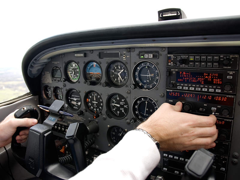
So, when I mentioned in the previous post that I wanted to "test an aircraft out before I took it through a potentially dangerous corridor of airspace," this is what I was talking about.  Flying into airspace you aren't cleared into ("busting the airspace" as pilots will say), gets you unwanted attention from the FAA, among others, depending on the airspace.  Flying into BWI's airspace is going to tick off some controllers, and the FAA.  Flying into the FRZ is going to tick off the DHS, the FAA because the DHS is riding them, and potentially the guy in an F-16 or Blackhawk sent to track you down (if it gets to that).  At its narrowest, that corridor is 2.6nm (just shy of 3 miles), so I tested the previous aircraft (N5294W) out to make sure I was familiar with it before putting my license on the line.  Luckily, N5294W has a moving map GPS that shows the airspace on it, so I could be sure to avoid it.

Well.
Life isn't that simple, is it?

I managed to wait too long before reserving the plane, so N5294W wasn't available.  The only other aircraft available had types of GPS that I wasn't completely familiar with.  Luckily, they're all reasonably similar, so adapting in my case would only take a few minutes.  Beyond that, I flew the flight in Flight Simulator to get an idea of what the terrain and cities would look like, in general, supplemented by going on Google Maps and drawing in extra landmarks on the chart.  While a familiar GPS would have added a good bit of situational awareness, I still felt equipped to make the flight without it.

In order to get through the corridor correctly, I departed Leesburg, headed direct to Gaithersburg (GAI), then direct to a VFR GPS reference point called VPONX, then direct another VFR GPS point called VPOOP (yes, VPOOP - in reality, it's "VFR Point" OOP), then direct Easton (ESN), and finally direct to Ocean City (OXB).

On the way out, we talked to the Potomac Approach position assigned to watching the SFRA, along with two other controllers when closer to BWI.  Once we were clear of the Class B airspace, I asked for flight following (ATC keeps an eye on you and issues traffic advisories as they can).  The last Potomac controller I talked to set me up with the service, and then passed me on to Patuxent Approach, which helped me make sure I wasn't in conflict with anything going on at the Naval Air Station (fast moving jets plus slow moving Cessna could cause problems).  Closer in to Ocean City, the controller dropped me to the local airport frequency so I could coordinate landing with anyone else in the area.

After landing, we grabbed a rental car that we coordinated prior to departure.  The guy who rented it to us just said "leave $20 under the driver's mat - the keys are in it."  That's one of the big differences between Northern Virginia and Eastern Shore Maryland, I guess.  In Northern Virginia, it's a credit card for insurance, a lockbox for a key, a contact number, your SSN, and a signed contract.  In any case, the car got us to the boardwalk for a quick run up to Malibu's (a local surf shop), and a small dinner, before running back to the airport.  If the Fractured Prune right by the airport had been open, I definitely would've stopped there, too.

I'd intended on departing with some daylight left, because the thought of flying the corridor at night made me uneasy (a lot of my references were on the ground and likely unlit), but the walk on the boardwalk and dinner took a little longer than expected.  Since it was definitely night before we even departed, I took advantage of the situation and took a lap around the pattern for night currency, and then headed west, talking to Patuxent to get flight following again, which is where things got interesting, in a good way.

While on Patuxent's frequency, I got to listen in on the controller setting a flight up for a Precision Approach Radar (PAR) approach, along with a pilot getting denied several times over because he was being demanding and impatient (wanted direct to the field, wanted to land opposite traffic flow, and so on). When I was switched to GRACO (a Potomac TRACON Sector for BWI), I opened my SFRA flight plan back to Leesburg, but I also requested clearance into the Bravo to avoid the FRZ as much as possible.  The controller had me climb up to 6500', and once at 6500', direct to the Baltimore VOR (BAL - a navigation radio beacon at BWI), and a heading of 290 (WNW) after BAL.  Getting closer in, two aircraft departed BWI.  Departure (the controller I was talking to) kept him at 5000', then direct PALEO (a navigation fix) to stay clear of me.  That aircraft passed a few miles in front of me.  The second aircraft was on a heading of 155 and was kept low as well, until he was clear of me.  He passed about 1500' below and nearly right under me.  To be honest, that was pretty cool.  Just before passing BWI, I was switched to WOOLY (another Potomac sector for BWI) and on again to MULRR (a Potomac sector for IAD). That controller called out traffic on my right side, and then got snippy on an interaction where he was trying to figure out what I was doing.  Apparently, nobody clued him in on the fact that I was assigned a heading of 290, so he asked.  Static in the transaction made it sound like he said "turn from your assigned heading direct Leesburg," but after hearing my readback, he came back with "no, I was asking if you were on an assigned heading, or direct JYO."  Oh well.  From there, I went over to IADFE (final approach controller for IAD), and the controller there kept me above the arrivals into Dulles.  Soon after checking in, I was sent direct to Leesburg.  Once clear of the finals for Dulles, I was given a descent and a switch to the airport frequency in order to land.

Overall, a good flight. I got 3.1 hours of PIC cross country time, with 1.7 of that at night.  Potomac saved me a lot of hassle and went a good bit out of their way to make sure I was set up tonight.  I'm headed out to the TRACON on Thursday, so hopefully I'll be able to pass a thanks along for the hookups.

Hours:
Pilot in Command Cross Country (PIC XC): 3.1 - 28.4 (of 50)
Actual/Simulated Instrument (Act/Sim): 0 - 3.6 (of 40)

22 August 2011

Back to Luray

N5294W - C172R - 1.7 hours

Note for other pilots:
The airport identifier for Luray is now LUA. Of course, everything hasn't transitioned to LUA, so W45 may still be needed in some cases. Flight Service mentioned it in the brief before the flight.

This flight came somewhat out of a random connection made at work, thanks to another one of the instructors (of the co-worker, non-CFI variety), and a need to test an aircraft out before I took it through a potentially dangerous corridor of airspace (more on this in a later post). Long story short, I met another pilot at work - Ashley - and we decided to take a flight so that I could test this plane, and she could get a feel for the local airspace as she's new to the area.

Since I just wanted to make a quick flight, I decided I'd head back to Luray. It's a short flight, but I can at least use the hours towards the cross country requirement of the instrument rating. After the preflight, a call to the FSS to file the flight plan, a second preflight by Ashley, and a few questions, we were off. The second preflight and the questions were things I fully expected, but I was also forewarned by her as it's her own safety thing. As a CFI, you experience a wide variety of students, many of whom often remind you that you need to always keep an eye on them. Since she is a CFI and hadn't flown with me before, the second preflight, and the questions were understandable.

To be honest, the questions also opened my eyes a bit to things some pilots take for granted. I began flying in this area, so terrain and airspace awareness are a huge thing to me, but I take it as it comes. To someone who began flying in flatter areas, the terrain can be unnerving. The same can be said for those whose first sectional had very little controlled airspace depicted, arriving in this area, where some of the airspace is very controlled, and even further, very prohibited. The questions about what I do to cross a mountain in the daytime versus the night were questions I hadn't consciously considered fully, much less many of the other questions. It's a good example of how to learn from someone else, really.

On the flight down, I explained some quick ground references that can help in remaining below the Dulles airspace, pointed out some prominent landmarks, and ended up getting 0.1 hours of hood time (it's not much, but every bit helps meet the 40 hour requirement). The approach to Luray was slightly off, as I turned too close to the field, so I ended up going around. After going around, we landed with a decent crosswind, taxied in, turned around and were back off. I ended up using the same cut over to New Market, up I-81 as I used before in order to buy time to talk to the FSS to refile a flight plan back in to Leesburg.

The route back brought with it some great shots of the sunset, and some familiarization with the airspace out in the Shenandoah valley. Along with it, though, came the dark of night and a slightly nervous CFI because not seeing the ground becomes an issue in the case of an emergency. As she put it, "if the engine fails, we're on a wing and a prayer." It's very true, but it's something you have to accept somewhat if you want to fly around here. This area is full of hills and trees, that are in most parts unlit. Other than not flying at night, there's not much you can do about it. Flying brings with it the risk of somehow no longer getting the option of flying. Managing that risk is still an issue, and one we'll continue to argue as long as we have wings.

Hours:
Pilot in Command Cross Country (PIC XC): 1.7 - 25.3 (of 50)
Actual/Simulated Instrument (Act/Sim): 0.1 - 3.6 (of 40)

20 August 2011

Catching "The Bug" (Again)

N172DR - C172R - 1.9 hours

My boss, Jason, is a pilot, but he hasn't flown in quite a while for various reasons. Yesterday, we were both talking, amongst other co-workers, about what I would be doing on my upcoming vacation. I had a couple ideas of what I wanted to do, but they either fell through or didn't interest me enough to pursue them. That led me to my comment "I'll probably just fly random places." Jason picked up on the comment and offered to chip in on a flight if I'd take him up. That being said, we eventually settled on Luray again, because it was short and simple.

We met up at the airport early in the morning, Jason having brought Fractured Prune donuts (the best, by the way). After wolfing down the fried rings of amazingness, I filed our flight plan, stopped to stare at a B-17 sitting on the ramp (that I'd actually serviced when I lived out in Phoenix and worked for Cutter Aviation), and walked out to preflight.

The weather for the flight, despite lower visibility, was great. The air was calm, the temperature hadn't quite come up yet, and there were few clouds in sight. There were, however, plenty of clouds that settled into the valley where Luray was located. West of that ridge, the rest of the Shenandoah Valley was completely clear. Because of that, I kept flying right past Front Royal, out to Staunton and headed down I-81 to Bridgewater (VBW). Oddly enough, Bridgewater was clear, while Shenandoah (SHD) was 200' clouds with 3/4mi visibility, and they're only 7nm apart.

Landing at Bridgewater brought us right over the college, where my brother went to school. Since he played football there, I went to the games as much as possible, but only drove past the airport a few times. I had never realized that the airport was used by a government contractor to refurbish aircraft for military duty. As I rolled out on the runway, I noticed King Airs, among other aircraft, sitting all over the airport and ramps, painted up in military colors. It really gave me the impression I was in the wrong spot, so we took a quick lap around the ramp and backtaxied to depart.

On the way back, I called the FSS to file a flight plan back in to Leesburg. When I landed, the B-17 we gawked at on the way out was just starting up for its quick run for veterans and thrill seekers. We taxied in, shut down, and went out for a quick lunch before coming back to watch the B-17 go back out one last time.


Hours:
Pilot in Command Cross Country (PIC XC): 1.9 - 23.6 (of 50)
Actual/Simulated Instrument (Act/Sim): 0 - 3.5 (of 40)

31 July 2011

Just Barely XC: Luray

N172DR - C172R - 1.6 hours

A note on the title: The FAA Considers (for the purpose of Private Pilot Licensing and Instrument Ratings) a flight more than 50nm (57.5 "regular" miles) as "cross country." Luray is 50.2nm.

I'd been trying to get my friend Kelly to join me on a flight for a little while, but our schedules hadn't met up until today. That being said, our schedules finally met up, so off we went. I decided to keep it shorter than the last few flights, so I planned a flight to Luray, VA (W45).

The day was the typical hot and humid day of the summer, so it made for a slightly uncomfortable taxi, but once we were in the air the temperature improved, though the turbulence was another story. The combination of the hot day, the hilly terrain and being forced to keep a low altitude (to remain under Dulles' airspace) made for a bumpy ride all the way out past the Blue Ridge mountains. After that crossing, it lightened up. Luray is in a valley, though, which creates turbulence issues of its own. That being said, we followed route 340 down the valley until getting close to Luray.

The approach to Luray is slightly odd for two reasons: Luray uses Approach Path Alignment Panels (APAP), and the runway slopes up (when landing on runway 4). APAP is a system of orange panels aligned so that when you're on the right glidepath (the angle of descent to the runway) they will all be lined up. It's very rudimentary when compared to the Precision Approach Path Indicator (PAPI) systems most pilots are used to. The PAPI uses lights to tell you if you're high or low. Here, I'm essentially telling if I'm high or low based on someone painting barn doors bright orange and sticking them in a field (in actuality, they're metal highway signs with the orange reflective coat on them). The runway slope issue confuses the matter because in most cases you approach a relatively flat runway. When you are used to how that looks, and you approach a runway that slopes up, you feel higher than normal, so your approach is somewhat off. Beyond that, actually setting the plane down becomes and issue because you have to point the nose higher to land the same as you would on a flat runway. If you think about it, the runway moves up, so you actually have to land in a slight ascent to land as if the runway were flat.

This being the first time I've flown to Luray, I had an interesting time adjusting to both the odd barn door approach path indicators, and sloping runway. Once on the ground, though, I taxied up to the tie-downs (parking spots) and caught a ride from the airport attendant into town. He brought us into the town and pointed us to a local burger place, called Artisans Grill, that claims it has the best burgers in Virginia. They used local beef, and it was actually pretty darn good. I'd say they rank up in the top five best burger places, but I'm not sure they take it. I'll have to go back for another try. Interestingly enough, as we were sitting there eating and catching up, one of the fans ended up shaking off one of its bulb covers, which shattered everywhere. Always interesting, right?

I called for a ride back to the airport, and we took a couple pictures in town before he showed up. Back at the plane, I attempted to get through to the Flight Service Station to file a flight plan back in, but Sprint and Luray's airport apparently don't agree with each other. In order to allow us more time and catch a smoother ride, I decided I'd fly out west to New Market, and follow I-81 north to Staunton, and back to Leesburg.

Luray Caverns Airport - W45

The flight back was uneventful, but bumpy, which didn't completely agree with Kelly's slight motion sickness, but she made it back in one piece so all was well. If you haven't flown to Luray, I'd recommend it. It's right by the caverns, and it's definitely a break from the city life.

Hours:
Pilot in Command Cross Country (PIC XC): 1.6 - 21.7 (of 50)

Actual/Simulated Instrument (Act/Sim): 0 - 3.5 (of 40)