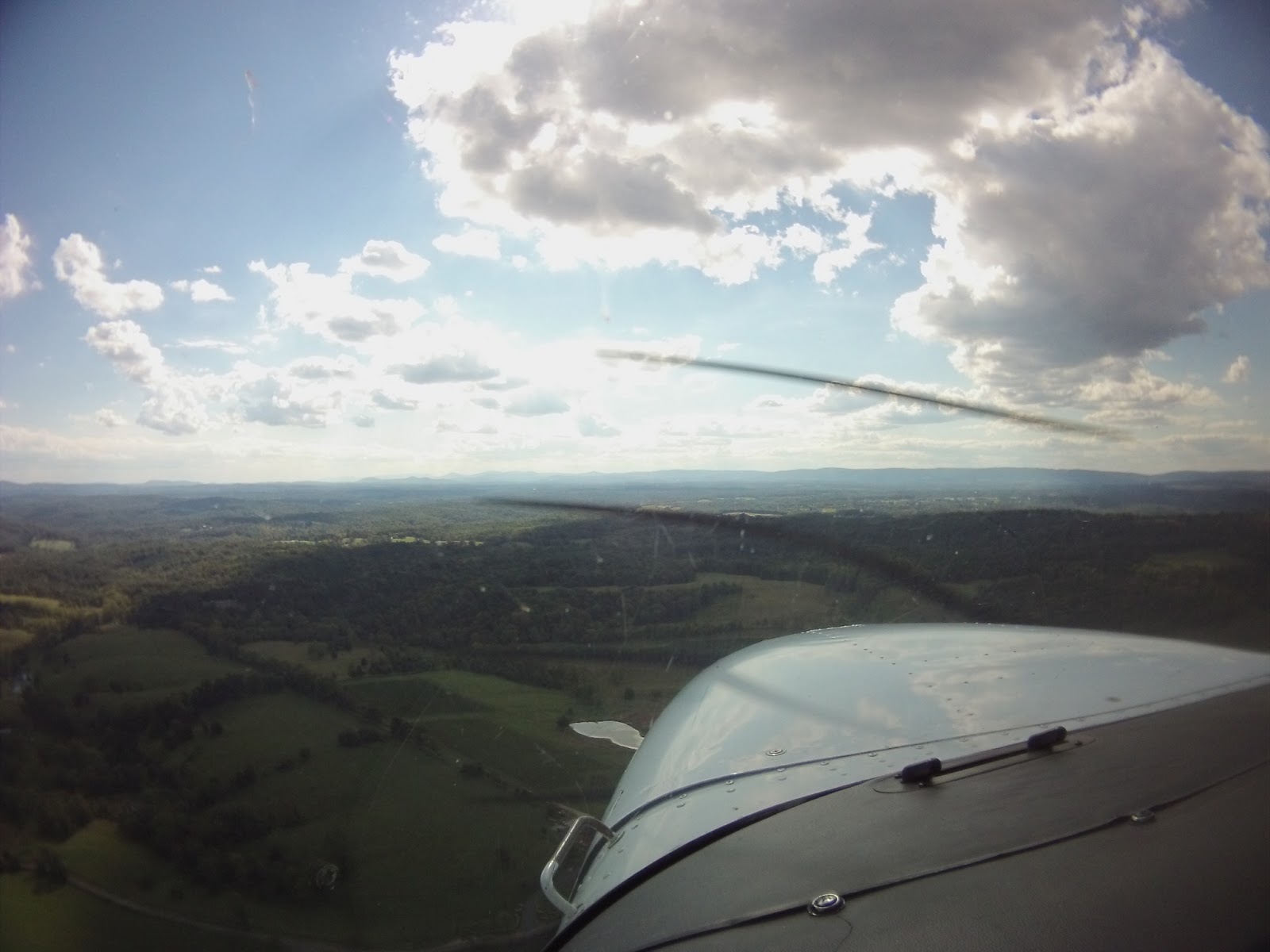
Since this blog is about flying, I tend to keep references to my personal life to an absolute minimum. In this case, though, I'll make an exception to give the flight some context. My stepdad is the coach of the football team at the high school I went to years ago, and they made it all the way to the state championship this year. Since it was down in Charlottesville - and you know how much I love Charlottesville (CHO) - I figured I'd try and get a flight in. In order to log some instrument time, I invited my friend Woody (of Dodging Traffic fame) to come along, too.
I think I have finally hit my limit on flight narratives for Charlottesville, so I'll keep it short:
We flew down. I logged instrument time.
The game went into triple overtime. My stepdad's team won.
We flew home. I logged more instrument time.
For being December, it was unseasonably warm, which also made the flight pretty pleasant. Today was a good day.
Hours: Pilot in Command Cross Country (PIC XC): 1.7 - 128.8 (of 50) Actual/Simulated Instrument (Act/Sim): 1.2 - 31.9 (of 40) Dual Complex: 0.0 - 7.7 (of 10) Total Time in Aircraft: 1.7 - 197.5 (of 250)
I don't know why, but for some crazy reason, I decided that I needed to take a flight on a Wednesday. What other reason might one need? Any excuse to fly can be a good one.
I'd been told for quite some time that I needed to go to the airport in Lancaster (LNS) to try out the restaurant there, but never ended up going for various reasons. Tonight would be the night that I would do just that, though.
Validation for the "back in my day" speech...
As soon as I got to the plane, I noticed that my night would be made somewhat more difficult by the GPS being inoperative. Never being one to pass up a challenge, I just pulled out my paper maps, stuffed them in the side pocket, and made sure my iPad was readily accessible. The planes that I flew when I first started out had nothing more than VOR or NDB navigation, so the lack of GPS felt somewhat like a homecoming of sorts. As I've mentioned before, the lack of of movable map to show the airspace is somewhat bothersome, but having flown in and out of Leesburg (JYO) for just over 12 years now, I'm familiar enough with the landmarks that the feeling of apprehension is manageable.
After departing, I made my way up toward Frederick (FDK), carefully keeping below the Dulles (IAD) Class B airspace above me, while also making sure to be above the tower airspace at FDK. To navigate up there, I used mostly ground references - cities and towns - in addition to the VORs at FDK and LNS.
Once up at LNS, I landed on Runway 31 and brought the plane over to the ramp near the restaurant. If you haven't been to Fiorentino's, it's worth a stop. Since it's predominantly Italian food, it's a welcomed change to the typically all-American style of most other airport restaurants that I've been to. Some of those others are really good at that fare, but it's pretty standard for most small airports: burgers, sandwiches, chips and fries. If you're good at it, you're good at it, but it's also nice to be able to go somewhere to get something different.
Sunsets: Always better from the air
The flight home was a good one, without too much wind or turbulence. As the sun set and ground references were lost to the darkness, I transitioned mostly VOR navigation. The last moments of the lightness on the horizon had a spectacular orange glow, made more dynamic with the grey of the clouds and darker blue sky showing through them. I snapped a photo, but it truly does not do it justice.
Hours: Pilot in Command Cross Country (PIC XC): 2.1 - 124.4 (of 50) Actual/Simulated Instrument (Act/Sim): 0.0 - 28.8 (of 40) Dual Complex: 0.0 - 5.0 (of 10) Total Time in Aircraft: 2.1 - 193.1 (of 250)
Earlier this morning I'd gotten a message about a local flight school needing an aircraft moved from Warrenton (HWY) to Leesburg (JYO). I immediately jumped on the opportunity, but soon thereafter I got some unfortunate news about a family member's health. In an effort to keep my earlier commitment while also being able to stop by and visit with said family member, I rented the trusty N172DR so that I could fly to Winchester (OKV) and spend time with family that would have otherwise been spent driving nearly two hours round trip. Granted, the flights together took up nearly 50 minutes, but that extra time made all the difference. Additionally not having to worry about the stresses of traffic, and the traffic lights on Route 7 was a lot better for my own sanity.
While it's good to remember to run the IMSAFE checklist to ensure you're fit to fly before any flight, it was even more important to do so today given the reason for the flight. A flight such as this one could put several pressures on a pilot, while the potential to be upset by the state of a family member could also serve as a major distraction. In my case, I kept in mind that I could always drive. JYO is conveniently on the way out to OKV for me, so continuing the drive if I felt out of sorts was not out of the question. The flight was not a matter of seeing family or not. It was simply a way of spending more time out there. Additionally, despite the unfortunate news, other than wanting to be with family as soon as I could be, there was no immediately time-sensitive concern as there would be if there had been a car accident or similar.
The flight itself was pretty standard. It was a little hazy and there were a few low clouds for the flight out, but nothing major. Now, off to take a C172M down to HWY.
Hours: Pilot in Command Cross Country (PIC XC): 0.0 - 107.0 (of 50) Actual/Simulated Instrument (Act/Sim): 0.0 - 22.9 (of 40)
My friend James and I have been talking about flying off and on for years. I actually met him when I lived out in Phoenix, which was partially the reason this blog came into existence (trip reports for my family/friends, as I'd intended to get my additional ratings out there back in 2008), and even though we worked at the same flight school, we had never flown together until today. Since we had been talking about flying and my last flight didn't go as planned, I figured we would try it again.
We flew up to Reedsville (RVL) through the use of VORs only. I'd planned on this, but we found that the GPS ended up being INOP when we got to the plane. As I was under the blinders for the flight, I was guided around a few cells all the way up to RVL, shot the LOC Runway 6 approach, flew the missed with one lap around the hold, and then flew the approach again for more practice. To get the cross country time, I touched the wheels down on the runway and then set off towards home.
Adding to this non-GPS challenge was some sort of issue (my guess is vacuum-related) that made my artificial horizon gauge unreliable. It's always an interesting situation when you've developed a good trust in your instruments, and then they start wandering on you. As I was flying the first LOC approach, I noticed that when the gauge shows wings level, I felt like we were turning, and the turn coordinator and directional gyro confirmed this. I never thought I'd get actual partial panel experience, but it was actually neat to see it in a controlled environment.
The route back was by VOR again, and finished with the ILS Runway 17 approach back into Leesburg (JYO). Another 2.7 hours of simulated instrument in the book, so I'll call that a success.
Hours: Pilot in Command Cross Country (PIC XC): 3.0 - 107.0 (of 50) Actual/Simulated Instrument (Act/Sim): 2.7 - 22.9 (of 40)
Today was primarily a last minute decision to take advantage of nicer weather and fly. This time, the plan was to fly up to get dinner at a restaurant in Hagerstown (HGR) that the DC-3 crew frequents with Phil and his friend Brittany. The flight up to HGR is pretty simple as you don't really have to even turn much if you're departing Runway 35. There is a tower there, though, so there is a little extra radio work. The flight up and back was barely 1.1 hours total, and part of that time was added by flying an approach to Runway 17 at Leesburg (JYO).
Phil, in keeping with his constant challenges (makes him a great safety pilot), "failed" my GPS and had me keep the blinders on until right above minimums. Despite chasing the needles some when I got closer to the airport, I ended up settling on the localizer and glideslope nicely and removed the blinders with the field right ahead. Can't argue with that.
Short flight - short post.
Hours: Pilot in Command Cross Country (PIC XC): 0.0 - 98.5 (of 50) Actual/Simulated Instrument (Act/Sim): 0.5 - 17.1 (of 40)
As of today, I’m back in the air and can legally go off on my own, exercising the privileges of a private pilot. I went up this morning with Tim (the instructor who helped me get checked out in the DA40 back in March) to complete my BFR. We were supposed to go up last week, but scheduling got in the way of that flight.
Today’s flight was nice and simple. The wind was calm, and the clouds were pretty high. The only detractors were that I needed to spray the plane down with glycol (de-icing fluid), and add two quarts of oil (ruining my shirt in the process). After all of the ground items were taken care of, we were off.
I’m always surprised by how easily flying comes back to me after long breaks. After clearing the ridge and getting out to the practice area, Tim had me demonstrate slow flight. After that came the rest of the typical PPL maneuvers: power on stalls, power off stalls, steep turns, and engine out procedures. In my never-ending drive to get more instrument time, I also asked if I could throw the blinders on to fly the approach back into Leesburg (JYO). The approach went well, though the glideslope wasn’t providing us an indication. Luckily, the approach is an ILS/LOC approach using cross radials to identify the fixes, so I just put the Frederick VOR (FDK) in the NAV2 spot and identified step down fixes that way. Despite some hunting of the LOC, I ended up on altitude and centerline in the end, which was a nice way to end a flight after a four month absence.
Given the nature of the flight I didn’t end up recording it, or even snapping a picture (got distracted with the glycol and oil before the flight), so this post is atypically light on visuals. The next flight should have more of that. Speaking of the next flight, I need to get my passenger currency back for a flight later this month, so expect another post sooner rather than later.
Hours: Pilot in Command Cross Country (PIC XC): 0.0 - 86.5 (of 50) Actual/Simulated Instrument (Act/Sim): 0.3 - 14.0 (of 40)
While the hiatus continues, I've been anything but relaxing. For those of you who don't know me personally (and even some who do), I've actually been staying pretty close to aviation during my break. A few weeks before my last flight, I got an invitation to be a beta tester for a company called Precision Manuals Development Group. The company specializes in creating realistic, study-level simulations of various aircraft for use in Microsoft's Flight Simulator. In my case, I helped test their latest offering: the 777-200LR/F. While I clearly have no time in the type, I was brought on as someone to stab around for bugs. I also ended up taking a few writing tasks. Testing will continue for the next few months, too, as they add the 777-300ER and -200ER to the product line.
I also ended up creating a few YouTube videos, showcasing the aircraft and explaining how to operate it. Interestingly enough, my YouTube channel, which had about 1,000 views up until that point, is now standing at 43,500 views. That's about 30,000 more than this blog at the moment. Given my success there, I'm thinking of branching the content into two different categories: flying (as exhibited here), and simulated flying. The sim side of things has always been a passion of mine mostly because it helps me survive the times when I'm not out flying in a real aircraft. There it is. I admitted to it.
The secret is out, people: I'm a giant nerd, too.
Then again, to some of you reading this, that's not at all surprising...
So, for those of you who are still not sure, I will now prove it to you:
As I mentioned, the simulator is my way of surviving the times I'm not out flying in a real aircraft. Given the right tools, too, it can be an incredibly strong asset to real flights as well. Granted, the sim I'm using is not certified by the FAA for logging time, but the concepts learned in the sim have saved, and will continue to save me valuable (read "expensive") time in training.
As you all know, The Doctor (N172DR) is one of the aircraft I fly most often. It's a simple plane, it's relatively cheap to rent (especially now that N96178 is gone), and for some reason, it tends to be available when I want to go flying. In the sim realm, another company known for high-quality simulations of aircraft is A2A Simulations, who just released a C172R. Of course, since I have so many hours in one, I figured it would be a good way to survive this hiatus and keep relatively sharp. I couldn't just go burning holes in the sky in just any aircraft, though. I fired up Photoshop and "painted" it up like The Doctor to the best of my ability.
It's not perfect, but I think I did a decent job at capturing most of its grandeur.
Judge away, but this is helping me stave off the flying cravings until I'm allowing myself off of this hiatus. I'm imagining I'll evaluate my various options for the long IR cross country flight using it, as well. I have a few other ideas, too, but I'll go into more detail in another post.
There's a ton to catch up on in the world of aviation and related technology, so expect me to get back on writing more often in the near future. Of note: some unfortunate news about Contour, updates in ForeFlight and CloudAhoy, and some new ideas for my online presence - both here on the blog and over on YouTube.
As somewhat of a last minute thing, a coworker of mine asked if I wanted to go flying so he could get his night currency back. I almost declined, having just gone last weekend, but since Eric is a CFI and I need to continue chipping away at the instrument requirements, I figured it was a good opportunity.
Since I didn't get my Grant County (W99) flight in last weekend, I figured I would fly the approach there, stop through Winchester (OKV), and then head back to Leesburg (JYO). That would give him three takeoffs and landings, and it would get me a decent amount of simulated instrument time.
Departing to the west, I put the blinders on and picked up the Linden (LDN) VOR, which is the initial approach fix for the LDA/DME-B approach to W99. Since LDN is pretty far away from W99, it gave Eric plenty of time to ask general flying questions before we concentrated on the actual approach. Unfortunately, in order to keep the localizer in the NAV1 spot, I had to put LDN in the NAV2 spot which was unlit. You can see the oscillations in the track as I wasn't as on top of it as I should've been (first going southwest towards LDN, and then I turned too early to the west, away from LDN). In any case, I made it onto the localizer in the end, which put me right on top of the field.
As you can see on the chart, the airport is surrounded by terrain, so much so that a straight-in approach cannot be made with the necessary safety margins required by the FAA. For this reason, the LOC is offset 25 degrees from the actual runway heading. Moreover, this is also why it is a localizer-type directional aid (LDA) approach instead of being a localizer (LOC) approach.
For those who aren't pilots, localizers are normally placed at the far end of a runway and provide lateral guidance to it. In this case, the localizer has been placed to the left of the runway, on the near side, because of terrain. Being on the near side means that it is more sensitive, and therefore slightly more difficult to track, when compared to a normal LOC approach at similar distances from the field. Additionally, because of the offset and the terrain, the minimum altitude you can descend to on the approach is 1540 feet above the elevation of the airport. Because you're so high, so close in, it is designed as a circling approach, where you wouldn't normally immediately line up with the runway to land (note that the chart only lists "circling" at the bottom, with no "S" - or "straight-in" - minimums); rather, you would spot the airport closer in, circle around the airport to lose altitude, and then to land. You can see this in the CloudAhoy track below (the knot at the far left of the blue line). While the concepts of the various approaches are similar, approaches like this offer somewhat of a challenge, when compared to those offering straight-in procedures (which is what you experience on 99% of commercial flights if the weather is poor).
I ended up overflying the field, and passing the controls to Eric so that he could make his landing. After a quick full stop landing with a taxi back, we departed to the north to avoid terrain. If you look back at the approach chart, you'll see that there is a valley north of the field to follow until you clear the mountains. Once above the terrain, I took the controls again with the blinders on to log more instrument time towards OKV. After Eric had OKV in sight, I passed the controls back to him for a lap around the pattern and a full stop landing. Since the weather was nicer, a few others were taking advantage of it for night currency as well, so I called traffic with the blinders off while we were in the pattern.
One of the pilots who landed before us decided to stop right next to the taxiway for some reason, but we managed to get by. After the departure, I put the blinders back on and took us back to JYO. Once again, Eric called the field in sight, I passed him the controls for the landing, and that was that. By the way, if anyone wants to see the perfect example of a full stall landing, see this guy.
From all of the questions throughout the flight, it seems I need to dig back through the books to brush up on some of the items I've forgotten over the years. It was a great flight, though. He has his night currency back, and I have 1.6 more hours of the instrument requirement (not to mention 1.6 more instrument dual).
Hours: Pilot in Command Cross Country (PIC XC): 2.1 - 84.1 (of 50) Actual/Simulated Instrument (Act/Sim): 1.6 - 13.7 (of 40)
I normally embed my flight videos right into my posts, but that's because I upload the raw video to Contour or YouTube as I'm writing. Since I edited video from three cameras together into one for the Dizzy Yet? flight, I uploaded it well after publishing the flight narrative. For now, I'll probably post the flight narrative with a couple videos, and then follow that up with the edited video in another post, as with the case here.
I know some of you probably saw the Facebook or Twitter links to it, but for those of you who haven't seen the finished product, here it is (make sure to switch it up to 720p HD):
I learned a lot making this video, so the videos in the future should be better.
I was supposed to go on a flight with my friends Matt and Mike this past weekend, but weather got in the way of that twice. Saturday afternoon was cancelled because of low clouds and rain, and Sunday was cancelled because of wind and turbulence. Of course, having just received my new mounts and camera, I was itching to go play with the new toys.
As I've mentioned a few times in previous posts, the commercial pilot license requires a certain amount of solo night flight experience, and a part of that is 10 takeoffs and landings at a towered field. I've passively thought of my options since learning of the requirement, and my general conclusion was that none of them were particularly good. Charlottesville (CHO) requires about 45 minutes just to get there, though the tower stays open all night. Martinsburg (MRB) is closer, but the tower closes earlier than I'd need it to. Dulles (IAD) would be great, but the A/FD says "no flight training after 2200 local," and you'd be nuts to try to request pattern work there. After some thought, though, I remembered that Frederick (FDK) now has a tower, and it stays open long enough to fit in 10 landings after dark.
At first, I figured I'd wait and just take care of the flight later, but between the days getting longer and the potential for controllers to be furloughed in the near future, I thought the best time would be now. I booked a plane, packed my stuff, and set off towards Leesburg (JYO).
Before preflighting, I set up the three cameras so that I could get some video of it from multiple angles. The video that came from them wasn't the best, but the angles worked out pretty well for the flight itself. They'll all look better with a day flight, too. You know, being able to actually see things makes video that much better.
Here's the ContourGPS shot over the nose:
[Video got lost when Contour closed down for a while.]
I imagine that the ContourGPS will always be up somewhere on the windscreen so that it can get a clear shot up to the GPS satellites, so you'll always have that typical angle to look forward to. The next angle, shot from the ContourROAM is out the right window, which caught some pretty cool reflections off of the right wing. You can see the sunset reflected, and the moon as I turn north.
[Video got lost when Contour closed down for a while.]
The final angle I got with the new ContourROAM2 was of the panel, which included my back. Phil shoots from this angle with his GoPro, and the end result is pretty cool looking. I'll try it out the next time I fly during the day. Unfortunately, I didn't bother getting a larger SD card for the new camera, so it cut out just before I landed back at JYO.
[Video got lost when Contour closed down for a while.]
I also managed to get myself a copy of Adobe Premiere Elements 11, so the video edits in the future should be a heck of a lot cooler. Don't get me wrong, Windows Live Movie Maker is a decent starting point (not to mention, it's free), but it can't pull off what I'd like it to. We'll see what I can put together as I learn more about the program.
The flight up to FDK was nice and quick, and I was worked into the pattern behind another aircraft to begin what I saw as my own version of the Daytona 500. In order to pass the time, I made each lap a game of judging how well I got the nose up in the flare. After three times around, I told the controller taking over for the last controller that I was going to be doing seven more laps so that he knew what the plan was. He worked me in between a couple others who showed up for pattern work, and another couple of IFR arrivals. The last few trips around the pattern were under the guidance of the first controller. Getting closer to the 10 landings mark, I actually lost count, despite making tick marks on the scratchpad of ForeFlight. After an insurance lap, just in case I had double counted a lap, I let the controller know on the upwind that I was done bothering her for the night and was heading back to JYO. As she and I exchanged salutations, another pilot in the pattern checked to make sure I was spacially-oriented well enough to get home with "you dizzy yet?"
With the assistance of ForeFlight, I kept myself below the Class Bravo airspace as I got closer to JYO. The landing, which would make 12 for the night, was a simple straight in approach to Runway 17.
[Video got lost when Contour closed down for a while.]
I'm off to mess around with Premiere Elements 11 to see what I can to do these videos. So far, I haven't found a feature to correct my bonehead error of not properly leveling the ContourGPS, so I'll try to make sure it's level next time.
Hours: Pilot in Command Cross Country (PIC XC): 0.0 - 76.2 (of 50) Actual/Simulated Instrument (Act/Sim): 0.0 - 10.5 (of 40)
After my trip to Italy, I had to jump right back onto another plane to head to San Antonio (SAT) for work, which meant I spent quite a lot of time in aircraft this month. As I was sitting on the connecting flight through Atlanta (ATL) to Dulles (IAD), I ran the mental math and it came out to be about 25 hours in the back of commercial aircraft. Of course, even though I spent all that time in aircraft, I couldn't log any of it. After landing at IAD, I decided that I'd take a plane out before the month's end so that I could at least log a couple hours.
After blowing up Facebook asking people if they'd like to join on a trip to Charlottesville (CHO), Phil and I worked out a plan for what we'd like to do. As with all plans down to CHO, we would fly down, grab some food from Timberwood, and fly back. Since Phil's brother was down near CHO, we also diverted course slightly to fly over where he would be.
When we got up to the airport, there was a sign up on the desk saying "NO STUDENT SOLO," which I asked about, because the weather seemed to be mostly okay, despite a lower scattered layer of clouds than what the METARs and TAF indicated. Apparently the conditions on the other side of the Blue Ridge mountains (towards Winchester - OKV) were marginal at best, which is where the practice area is. I was warned to be careful about low clouds, and to keep it legal. For those who aren't quite clear on why it would be illegal, the reason I've been doing all of this flying is to get my instrument rating, which, in simple terms, allows me to fly in clouds and poor weather. It's a separate rating because it is more difficult to control an aircraft and navigate by looking solely at gauges and dials in the aircraft, and not out the window. Until you have that rating, you have to keep away from clouds.
After another quick check of the weather both online and outside, Phil and I set off to take up a plane in the fleet that I had not yet flown. Oddly enough, the last time I flew, I walked by it noting that fact and thought to myself "maybe next time." Phil checked the fuel while I gave the aircraft its shakedown, and then after tossing way too many electronics into the aircraft, we set off towards CHO.
As soon as I could, I threw the blinders on after departure so that we could both start logging time. Phil kept us clear of the clouds, while I brought us out towards Upperville (2VG2), and then slightly west of the normal course to overfly Wolftown, VA. We had to descend a couple times to avoid the clouds, but they lifted as we flew south. After practicing a couple turns around a point, which turned out to be the wrong point (house), we almost gave up to land at CHO when Phil got a text message with his brother's location in a field. After turning around, we spotted them standing next to their truck and took a couple laps around them before heading back towards the airport. On the way, tower assigned Runway 3, and then switched it to Runway 21 because the wind shifted. The change in runway ended up saving us some time with a straight in landing.
The video picks up after passing Piney Mountain. The banter in the background is both Phil and me negotiating my target on the runway, which ended up being the old numbers and the new thousand foot markers. After that, you can hear me groan a bit as I realized I missed it, Phil asking if I'm going to get the nose up for once, and then me groaning a second time about letting the plane float. The landing was pretty smooth, but in an effort to jump off at the first taxiway I pressed a little too hard on the right brake, causing it to skid. You can hear me jokingly denying it and then reading back the taxi instructions before the clip ends.
[Video got lost when Contour closed down for a while.]
We passed a Gulfstream on the way in, and for the first time in the entirety of parking at Landmark, nobody came out to park me. I, of course, took it as an opportunity to park wherever I wanted, and did just that. The rampies were actually busy towing another plane, but one stopped by to check on us and see if we needed fuel before returning to marshal another plane out. It was only after walking inside that we found that the crew car had just been taken by the pilots of the aforementioned Gulfstream. I gave Keya a hard time about letting someone take my car, but her retort was something to the effect of "well I had no idea what to do with it since you haven't been around in so long." Valid point. It wasn't a huge deal in the end as she just dropped us off with their van.
Brief pause for Clint Eastwood burger consumption.
Getting ready to head back, I paid for the fuel, and then Keya asked me a ton of questions about the Superbowl in order to get some idea of how to fill her pool sheet out. Phil and I walked back outside to set up all of the electronics again, started up and set off towards JYO. Since I've started a tradition of my own signature departure from CHO, here's the video of it.
[Video got lost when Contour closed down for a while.]
After turning on course, I threw the hood back on to log more time, which amounted to 0.9 hours of hood time for the day. Just 0.5 hours left before I could finish the rest of the instrument requirement in a simulator if I really wanted to, but where's the fun in that?
Getting closer to JYO, and after switching controllers, our radar service was terminated because the radar up at IAD wasn't picking us up in all of the snow. For a second, we came back up, but then dropped off again, so I told the controller we'd cancel the radar services and just utilize the normal JYO Maneuvering Area procedures. It added a couple minutes to the flight, but it also kept us from giving the controller a headache. The clouds dropped back down again, along with the visibility because of the snow falling. Similar to the rain video I got a while back, the snow looks like you're hitting light speed as it flies by. It was somewhat unnerving to hear Potomac working an IFR flight on the ILS Runway 17 approach to JYO as we continued in visually, but we sequenced ourselves properly over the frequency, landing in between that IFR Cirrus, and another VFR Bonanza behind us.
Right before I shut down, I snagged the AWOS weather report for insurance in case anyone questioned how visual the weather really was: KJYO 262115Z AUTO 32005KT 5SM -SN BKN038 OVC044 00/M02 A3026 RMK AO2
I wouldn't recommend buzzing around an area you don't know very well in conditions like that, but if you know the area well and have good tools for situational awareness, you can remain reasonably safe even in degraded conditions. I'll put it this way: I'll take those conditions in the day over clear and moonless with a low altitude at night.
Another awesome flight for the books.
Hours: Pilot in Command Cross Country (PIC XC): 2.0 - 76.2 (of 50) Actual/Simulated Instrument (Act/Sim): 0.9 - 10.5 (of 40)
Phil and I have had plans to go flying for a while now. Originally, it was a flight back in May, but that got cancelled so I flew out west on my own. I'm pretty sure there were a few plans in between, but more recently we were thinking of helping a friend get home to Upstate New York. Those plans also got cancelled as well, so like the flight back in May, we thought we'd head up to State College, PA. Yesterday, we decided that flight would be a little longer than we would've liked, so we cancelled those plans as well and opted for a challenge instead.
To be honest, that last paragraph reminds me a little of this:
Back in February of 2010, I went for a flight out of Harford County Airport (0W3), right after one of the Snowpocalypse storms. If the 2000' x 40' runway wasn't enough of a challenge, some of the snow plowed off of the runway was piled at the ends. It wouldn't be enough to force pilots to hit a 2000' x 40' target, though. Why not add in a 24' telephone line 500' from the runway, and some giant trees just beyond that? This is also not mentioning that I hadn't flown since August of 2008 prior to that. Despite it being a challenge, I really enjoyed it. I think that was the reason I enjoyed it, actually. It's a challenge.
We started the day early in weather that could only be described as "severe clear." Clear weather, however, makes no mention of temperature or wind. While it wasn't too incredibly cold, it was cold enough to put frost on the wings. The wind only added to the chill at a steady 6 knots. Phil preflighted the plane while I de-iced the wings of our plane, and several other aircraft on the way to put the de-ice bottle back inside. Back outside, I got the interior all set up with Phil. In the last flight narrative, I made fun of myself for the amount of technology I bring with me, but we essentially doubled it this time. Phil had his GoPro, iPad, Dual XGPS150, and the audio setup. I had my Contour, iPad, Garmin GLO, and audio setup as well. Why not?
After starting and heading down to the end of Runway 35, I called Potomac to get my SFRA flight plan activated. Apparently they didn't get it, though, so instead of bothering with Flight Service, Phil and I gave up the plan of a shortcut through the SFRA and just departed north, up and around it. On climb out, my iPad was not agreeing with the Garmin GLO for whatever reason. Phil ended up getting it sorted through cycling the power on both. Once that was all sorted, I threw the blinders on so that we could both log time (and I could continue to chip away at the 40 hour instrument time requirement).
Because we didn't get an SFRA clearance, we flew a route that would hug the outside: DINUW LINSE TAFFI 0W3. In order to log another approach, I flew the RNAV (GPS)-B off of TAFFI.
One of the issues with flying GPS approaches is that you never know whether or not the GPS database in the aircraft is up to date when it comes to renting from flight schools. It all depends on the school, really, but the one I rent from tends to be pretty good about keeping the aircraft up to date. The ever-so-trusty N172DR has a KLN-89B, and looking at the unit, it seems pretty simplistic. If you're a flyer of an aircraft with a simpler-looking GPS, don't discount it too much as a lot of them have some pretty neat features buried in them. Unfortunately, most of the CFIs don't know a lot of the features and normally only show you how to use the Direct-To feature. That's nothing against them, really, as some fleets have different equipment in just about every plane, but it's tough to utilize the tools in front of you if you've never been shown how. If you're not going to be shown the neat features, you might as well go learn them on your own. The KLN-89B actually has a free simulator that's out there on the internet. Unfortunately, I can't find a link from the manufacturer, but I did find a link through Software Informer. If you fly with a different unit, there's probably a free simulator out there somewhere as well. To be honest, the only reason I knew the KLN-89B had a moving map and an approach database was through the simulator in the link.
So, all that to say I was able to load the GPS approach after TAFFI through a little homework. Since the GPS was only going to give me lateral navigation, I flew the approach with step downs. Looking at the track in CloudAhoy, I didn't do too poorly. At the far left, you can see a very subtle bend in the track, which is my turn over TAFFI. After that, the more obvious turn in the middle is SNAZI, where you can see I turned a little more than necessary, and had to adjust closer to the field in order to land on Runway 10. I'll review CloudAhoy in another post, but check out the screen capture in Debrief Mode.
When I began the approach, I checked BWI's ATIS as noted on the approach plate, as there's no weather station on the field. It noted the wind was 040 at 9, meaning a nice crosswind for the approach, but nothing too unmanageable. After the little sidestep at the end of the approach, I brought the plane in for what I thought would be a nice showing of my landing skills. Unfortunately, the weather had other plans. The 9 knot wind wasn't so much of a 9 knot wind as much as it was a gusty 9 knot wind. It wasn't until I landed and checked the weather that I found out how gusty exactly.
In any case, here's the video of me fighting the crosswind down to the runway. Closer in, you can hear Phil say "nosewheel," anticipating me hitting nose first as I bring it in typically flat. I think I managed to hit the mains first, but wound up airborne again. I couldn't get it to settle and the end was coming up quickly, so I went around. Note the telephone line and giant trees at the end that I mentioned earlier, too.
[Video was here until Contour closed down for a bit, and all was lost.]
After going around, I wrapped the pattern back around to try the approach to Runway 28. In the video, you can see that the wind sock shows the wind somewhat favored Runway 10, but the last time I flew here I used Runway 28, so I figured I'd try that.
The second approach wasn't any better than the first, so I went around. The third attempt, however, was good enough to set down. I won't say it looked pretty because it really didn't, but I at least made it down to the ground, despite a gust picking the right wing up slightly, causing me to drag the right wheel while trying to brake. Thankfully, I had Phil to dump the lift by raising the flaps when I called it.
The video picks up on final, and you can definitely see how close you come to the trees and the telephone lines this time around. Contour changed the style of the videos as well. I'm not so much of a fan of the new overlay, but it is what it is. Just make sure not to pay attention to the speed display. It's not very accurate, which you can see as it still displays 70 mph when I'm pulling off the runway.
[Video was here until Contour closed down for a bit, and all was lost.]
As I exit, you can barely hear me coordinating with the aircraft holding short of the runway, who I later joked with about the luxuries of longer runways. Because I don't have any specific audio editing software, or audio hosting for that matter, I made it into a short YouTube clip:
After that departure, we headed back to JYO and I put the hood back on. Closer to Frederick (FDK), I remembered that they now have a tower and that I would need to avoid their airspace, or call them up. I opted for the former by climbing above it. The controller seemed to have his hands full with a couple pilots still adjusting to the relatively new tower, and I didn't feel like adding to his workload. After turning south, I handed the controls over to Phil so he could get in a landing. Compared to my landings, his was nice and smooth.
Here's the evidence:
[Video was here until Contour closed down for a bit, and all was lost.]
After I got home and checked the weather, it turns out that BWI's weather information updated right after I flew the approach. This report matches more of what I felt:
For the non-pilots among us, this is saying that the weather at BWI (KBWI) today, at 1454 UTC (171454Z), had wind from the northeast at 12 knots gusting to 21 knots (04012G21). The rest is sky conditions, temperature and pressure.
Definitely an airport I would return to - wind or not. I loved the challenge.
Hours: Pilot in Command Cross Country (PIC XC): 1.8 - 74.2 (of 50) Actual/Simulated Instrument (Act/Sim): 1.3 - 9.6 (of 40)
I'd have to say that autumn is my favorite season of all of them. It's not too hot, it's not too cold, and although it's a little rainy around where I live, the leaves changing colors is pretty cool. When I woke up this morning, I didn't think I'd go flying, but I did note how awesome one of the trees in my neighborhood looked. When someone I met at work mentioned going flying, I knew exactly where we would be going.
No, not Charlottesville.
One of the better places to go around here, if you're looking to check out the fall colors, is Skyline Drive. To the west of the ridge line that Skyline Drive follows is the Luray Valley, which is part of the Shenandoah Valley. If you've ever been on Skyline Drive and thought it looked cool, you should see it by air.
Because Marcy and I wanted to actually see the colors, we were presented with a little time issue. Meeting up at Leesburg (JYO) would've meant losing daylight after work, so I agreed to fly down to Manassas (HEF) to pick her up, and then continue to Luray (LUA). This, of course, presented me with a little airspace issue.
The direct path would really get me in hot water with Dulles Tower, as you can see in the picture on the left. Another option was to head out of the SFRA (the blue hatched arc with a white background in the picture) to the west and remain outside almost all the way until HEF. That option would take more time, but it gave me more room to work with. The final option is somewhat less obvious, unless you're really looking, and you're really comfortable with ATC and airspace. The four blue lines near the center of the picture are the runways at Dulles (IAD). The thick blue circle surrounding it is the airspace that starts at the ground and continues up to 10,000'. The next ring out is airspace that starts at 1,500', which you can see over JYO. As long as I stay under that 1,500' shelf of airspace, west of the floor airspace, and talk to Potomac Approach for clearance into the SFRA, I'm golden.
If you look closely, I even have a good landmark to keep me out of the floor airspace (aviation term for airspace that starts at the ground): Route 15. What you can't really see are the Bull Run Mountains, which I've talked about before in past posts because they're tall enough that you can't fly over them with legal clearance, yet remain below the Class B airspace. So, if I stay at 1,300', west of Route 15, and east of the Bull Run Mountains, I'm set. It really isn't the most ideal route - I don't really like being kept that low to the ground, and being close to airspace always makes me a little nervous - but it shaves enough time to make it worth it. I definitely wouldn't try it at night.
I took my time with the preflight, since I was slightly ahead of schedule, but still managed to get out ahead of a couple inbound aircraft. Once airborne, I coordinated my departure path with one of those inbound aircraft as flying the standard pattern would have meant cutting him off. I've noticed I've gotten a lot better at spotting traffic, for reasons I'm sure you already know if you've been following the blog for any amount of time. After I was clear of the traffic, I called Potomac up and got cleared into the SFRA. From there, I turned southbound to follow Route 15 down to Haymarket.
IFR really means "I Follow Roads" right?
(Route 15 runs right up the middle of the image)
Closer to HEF, Potomac passed me over to tower, who set me up on a left downwind for Runway 34R. If the pilot or ATC-side of you thought that last sentence was odd, mine did too. In the world of ATC, however, never forget two words: operational advantage. While putting me on the left downwind for runway 34R made me cross the final of 34L, it kept me away from two helicopters using 34R.
After landing over a construction team still working on extending the runway, I taxied off to the main terminal. Unfortunately, the main terminal doesn't have any parking spots painted on the ramp, so I asked the ground controller if she knew anything about the parking situation. She said she didn't, but offered a frequency for one of the FBOs next to me. The person who answered the call at APP Jetcenter was the GM, as I found out later. He gave me instructions on where to park, and even came out to marshal me into a spot as all of the other rampers were busy with other aircraft. I was pretty impressed, especially having been a ramp agent and supervisor myself.
I decided to try something new with the videos. I've always wanted to be able to add the voice communication to the recordings I take, but everything gets drowned out by the sound of the engine. I actually bought a cable to work with my voice recorder a while ago, but just got it (story and review of that will come at some point). With it, I'm now able to record the audio and then overlay it using the same program I use to create the time-lapse videos. This is the result:
It gives it an interesting new feel, and now I don't have to try to explain the things I find funny on frequency.
The rest of the flight was pretty simple. After taking off, tower kept me on runway heading for departure traffic on Runway 34L. Once that traffic turned southbound, I got my turn on course and frequency change to Potomac. Despite listening in to the frequency for a few seconds and calling when it was clear, the controller snapped back with "all VFR traffic standby!" As I've mentioned before, controllers often work combined frequencies, so you can't always hear the other traffic on the frequency. While the tone did seem a little unnecessary, I shrugged it off. In any case, I continued on my way to LUA, climbing under the Class B airspace. After crossing the mountain ridge, I descended into the valley to get a closer look at the colors and continued inbound to the airport.
After landing on Runway 4, I parked the plane on the North Ramp and got a ride into town from Kenny for dinner at Uncle Buck's. If you haven't flown in during the week, you probably haven't run into Kenny, but he's a great guy, just like John. They have a good crew down there.
The flight home was pretty quiet, and the landing at JYO was uninterrupted as there aren't many people who fly later in the day on weekdays. After landing on Runway 17 and parking the plane back in its spot, it took a while to get all of my technology out. It hadn't occurred to me until just now how much I have in there: the Contour, the iPad, the Garmin GLO, and a voice recorder. That's all on top of the other normal items.
No idea where the next trip will take me, but I'm not going unless I can get some simulated instrument time. Yes, that's an invitation to my other pilot friends.
Hours: Pilot in Command Cross Country (PIC XC): 1.9 - 72.4 (of 50) Actual/Simulated Instrument (Act/Sim): 0.0 - 8.3 (of 40)
The other night, I was hanging out with my friends Christina and Brittany and the idea of flying this weekend came up. No plans were set in stone, so when the idea came back up I was somewhat surprised. At first, since the flight would be between lunch and dinner, I figured we'd just fly down to Luray (W45) and back. As the time came to head up to the airport, I changed my mind and decided and Charlottesville (CHO) because I needed food, and you all know what my go-to is by now. Just like last time, the plan was to head to Timberwood Grill. I've been there all too much over the past year, so I'm going to go on the record and say that trips to CHO are going to be drastically reduced for a little while. I feel like I'm missing out on a lot of other destinations.
Sorry Timberwood - I still love you.
On to the narrative.
After getting to the airport, Christina, Brittany and I grabbed the flight book and headsets, and walked out to the plane in weather that I'd consider to be just about perfect. After the preflight, they both climbed in the back while I set up my Garmin GLO GPS (which I just got in the mail on Thursday - I'll review it with ForeFlight eventually), ContourGPS, and the rest the technology.
The taxi out took a longer amount of time than normal because the nice weather brought everyone out. Whereas there are normally only one or two people ahead of me, I ended up heaving two departures and two arrivals ahead of me by the time I finished my engine run up. Once they had all done their thing, I was able to get up and out. I got a video of the departure, but it was just downright ugly with the wind that had picked up so I didn't upload it. This being Brittany's second flight ever - not just in small planes - the bumps weren't appreciated. Reaching cruise, though, the bumps smoothed out.
Yes, this is the big EMB-145
Getting closer to CHO, I called the tower and was instructed to call back when I reached the downwind for Runway 3. As I entered the downwind, a Piedmont (regional carrier for US Airways) Dash 8 called in and was cleared to land ahead of me. I turned in behind it, landed, caught the first exit and brought it in to the Landmark ramp. I had the Contour running the whole flight, but I didn't upload any of it because nothing truly interesting happened (and I'll admit the landing wasn't the best, either). After parking, an American Eagle (regional carrier for American) Embraer 145 taxied out to the runway, prompting Brittany to comment that "it's so BIG!"
As usual, I was greeted with "you gonna want the crew car?" As much as I like being recognized, this is more evidence that I need a break from CHO. In an effort to break the norm in some way, I actually switched it up at dinner and got an Al Capone burger.
ForeFlight running with a Garmin GLO
and iPod on the aux input
On the way back, I spent a little more time testing ForeFlight, while we listened to my iPod through the aux cable I bought a while back. For those who are wondering how that works since pilots need to listen for other pilots and air traffic control, the aux input is overridden any time someone speaks, either in the aircraft or over the frequency. That ends up making listening to music frustrating at times, but it's worth it for longer flights, especially at night. Having GPS input on ForeFlight really makes it that much more worth it, as well. Now, every plane I fly essentially has a moving map GPS. Granted, I can't shoot approaches with it, but it really helps.
As we got closer to Leesburg, the bumps picked back up as a result of the wind having increased and the lower altitude. The JYO traffic frequency was really busy with one in the pattern, a MedFlight helicopter inbound, and two other aircraft approaching from the north. The two approaching from the north had apparently gotten really close to each other, and there was an interesting exchange between the pilots that clogged up the frequency for a while. I compensated by making my calls really short, but I still ended up getting stepped on a couple times by the other pilots. Despite all of the radio traffic, I managed to get in during a break in the traffic.
You'd think that it was easy from then on, but it wasn't. The wind really messed with me, with gusts making it difficult to hold a proper speed down to the runway (which you can definitely see in the graph to the right of the video below).
Enjoy said video of me getting my butt kicked all the way down final:
[Video was here until Contour closed down for a bit, and the video was lost.]
Didn't expect that greaser of a landing at the end, did you?
Hours: Pilot in Command Cross Country (PIC XC): 1.7 - 66.8 (of 50) Actual/Simulated Instrument (Act/Sim): 0.0 - 7.5 (of 40)
There are very few things in the world that I would prefer to do more than flying, so when it comes to what I do on my birthday, an airplane is likely involved at some point. Last year, my friend Jason and I flew down to Bridgewater (VBW) and ended up catching a glimpse of a B-17. This year, I took the day off from work in order to relax and fly. My friend Ashley managed to leave work a little early as well so that we could fly and be back in time for a dinner out with some more of our friends. Unfortunately, the weather didn't have the same plans. Fortunately, a little patience, good company, and a nice pilot lounge ended up working out.
After we arrived at Leesburg (JYO), we grabbed the keys for the plane and walked out to preflight. One of the instructors had just gotten back in and gave us a weather update that there were storms over the ridge heading towards us. Ashley and I had been checking the weather all morning, mostly because the ceilings had been so low the last couple days, but I was definitely aware that the weekend's second front was passing through.
We continued on to the plane to check it while watching the weather. The guy said there was a storm, and I believed him, but a lot can be said for actually seeing the weather. I figured we could at least get our stuff situated in the plane while keeping an eye on the sky. Unfortunately, as can be seen in aviation lore and AOPA magazines all over the place, pilots make bonehead moves and press on despite weather issues. Because I kept walking towards the plane after the instructor had warned me of the storm, I'm guessing he got the feeling I was going to try to beat it, so he walked out, iPad in hand, to show me the latest radar images (the center + is IAD, with JYO's + slightly northwest of it):
What he hadn't seen was the fact that I did actually check the weather, and that the radar loop was still running on my phone, so his concern was understandable. It's nice to see that we'll look out for each other, but there's a sad side to that coin as well: despite all of our training and warnings of "get-there-itis," pilots still give other pilots reason to express their words of caution. I told him my plan was to preflight, watch the weather, and set things up so that as soon as the front passed, we could go. That seemed to restore some of his faith in me, and before he walked back inside we talked some about his iPad's ForeFlight setup.
After we had set up out headsets, my camera, and everything else, the wind picked up and the the rain arrived. Ashley and I retreated to the pilot lounge and watched TV while the storm blew over. I also kept an eye on the weather using ForeFlight's radar overlay and looking out the window. As soon as it passed, though, we walked back out to the plane to give it one more look and set off towards Charlottesville (CHO).
The departure was standard, and as soon as I could, I put the blinders on to log some simulated instrument time. Over Upperville (2VG2), I called Potomac to get flight following, and give Ashley a feel for who to call and when. Before I put the blinders on, I got to see some of the coolest clouds I've seen to date in the low areas and valleys. They're not as obvious in the picture here, but you can see them in the video. Ashley took this picture about half way down to CHO, and you can see the clouds almost seem to be resting right on top of the trees. Storms can be violent, but the clouds and smooth air that were left behind were really nice.
As soon as I got handed off to CHOWE (the radar controller serving CHO), I asked for a practice ILS approach to Runway 3. It had been immediately rejected, but I thought I heard "roger" so I waited to hear back. A new controller stepped in soon after, and after I reported to him that I had the weather information at CHO, I asked again about the approach. This controller came back with a slightly longer answer of "Not approved - can't do opposite direction anymore after DCA screwed it up the other week" (referring to the incident at DCA on 31 July). Since I couldn't try the ILS to Runway 3, I asked for the RNAV GPS Y to Runway 21, which was approved. You can see the tail end of the approach here in the video:
[Video was here until Contour closed down for a bit, and the video was lost.]
The whole approach can be seen in the time lapse video at the end of the post.
After landing and shutting down, I brought Ashley to Timberwood for what was originally going to be dessert or something light, but the delay put us more in the dinner mood, so we got burgers instead. After dinner and the drive back, we were back up in the air to head home.
The flight back was pretty peaceful, and I got more simulated instrument time. Since it was getting dark, and not being able to see terrain is unsettling, I took the blinders off to have extra eyes looking to make sure we were headed in the right direction. Adding to the tense setting, I managed to forget to stop by the rest room before departing CHO. Luckily it wasn't bumpy. You know the rest.
Hours: Pilot in Command Cross Country (PIC XC): 1.7 - 65.1 (of 50) Actual/Simulated Instrument (Act/Sim): 0.9 - 7.5 (of 40)
Earlier this week, Ashley asked if I wanted to go flying soon. Of course, I'm always up for a flight and we both had time tonight, so I set us up with a plane for some flight maneuvers and perhaps an approach. Her friend Greg also joined us to get a feel for flying the smaller stuff. As far as flights in small planes go, this would be his first. Unfortunately, throughout the week, the forecast had a decent chance of storms in the evening. Leaving work, I could definitely see some convection that could get in the way, but summer storms are spotty and I know there are a good number of airports locally should we need to get down quickly.
While Ashley and Greg were caught in traffic, I got the plane all set up, and then relaxed in the shade under the wing for a few minutes. Once they got there, Ashley ran through her own checks of things, explaining them to Greg.
I-66 below and 522 in the distance
After we all got situated, we departed to the west so that we could fly around the practice area (out by Winchester, VA). On the way out, I took advantage of the fact that there was another pilot on board and got some hood time until we got out there. Once there, Ashley took over to get some time at the controls to brush up on turns around a point and s-turns. After a few attempts, hindered by the wind of a storm a few miles to the northeast of us, I was given the controls again for some hood work. Ashley called out directions and I followed them to the best of my ability.
Of course, even though I checked to make sure the camera started the recording, it apparently died before I plugged it in after starting the plane, so I caught the few moments up to starting the engine and that was it. The hood work, rainbow and lightning all went unrecorded. Unfortunately, all of these issues were brought on by myself. I never charged it after using it last, figuring I had enough time left to run it until I had a chance to plug it in. Oh well. Greg caught the rainbow with the still camera, so all wasn't lost.
In the end, Ashley directed me closer and closer to Winchester (OKV), where she could practice a few landings. Since it had just rained and the runway was recently grooved, it was actually pretty cool looking. The last few feet on either side didn't have grooves, so the rain made that part shiny, while the middle appeared perfectly dry. After a couple trips around the pattern, I was handed the controls again and took us north towards the Martinsburg VOR (MRB). Even though I didn't have my charts, my ForeFlight trial had expired, and I didn't want to look the chart up on my phone, I was still able to fly the approach by pulling it up in the KLN-94 GPS. As opposed to the last logged approach, this one was a lot better. We'll see how it looks next time.
I'm still trying to get over the fact that I need the same amount of time that it took to get my private pilot license under the hood for my instrument rating. At least this flight took a full hour out of that total.
Hours: Pilot in Command Cross Country (PIC XC): 0.0 - 56.3 (of 50) Actual/Simulated Instrument (Act/Sim): 1.0 - 6.6 (of 40)
At first, my old college roommate and I were supposed to head up to State College (UNV) on Wednesday so I could head out to a new place and get some hood time. That ended up getting scrapped because the weather was less than ideal. Then, on Friday, I was supposed to head out with Ashley on a flight similar to our flight a month ago, but her job got in the way. Life and weather both happen, so you work the hand you were dealt. The tease of flying got under my skin though, so I was going flying with or without someone else in the right seat.
Similar to my last flight, I had a couple destinations in mind. To the west, I picked out Grant County (W99) because it's a quick trip and it's surrounded by mountains. To the east, I picked out Bay Bridge (W29) because it's through the VFR Corridor, which is a challenge, and it's right out on the Chesapeake Bay. In the end I picked W99 because I really didn't want to bother with a flight plan, or the SFRA.
Note the odd trend of laziness when I don't have people to fly with. Oh well. As long as I'm doing what I need to do to stay safe, I'm allowed to pick destinations based on how little effort they require if it's only for myself.
What haze?
I had left my sun glasses in the plane last flight. Thanks to the staff they were sitting in the book when I grabbed it out of the lock box. Nothing at all interesting happened on the way out. The weather, however, wasn't the most optimal, with a little haze when facing the sun. After passing north of Upperville (2VG2), I called Potomac Approach for flight following, which continued with Washington Center all the way out to W99.
Similar to Bedford County (HMZ), W99 is buried in the mountains. Unlike HMZ though, it doesn't have any mountains on short final. According to the Airport/Facility Directory (A/FD), there's a fly-in campground on the field somewhere, but I didn't see it. Sounds like it could be a fun outing if I ever figure it out. After taxiing back, I made a short and soft field takeoff to keep it interesting, as usual.
On the way back, I let Washington Center deal with its business without having to look after me since the frequency sounded busier. I monitored the frequency all the way back to Strasburg to listen in for traffic, however. Strasburg is where the grandparents live, so as I passed over, I descended to about 1000' above ground level (AGL), circled once, and then climbed back up and continued on to JYO.
Closer in to JYO, I set myself up for an approach to Runway 17, landed, taxied off and shut down. Hopefully next time will be more exciting. W99 is a cool airport, but it's less interesting to me when there's nobody to share it with.
Hours: Pilot in Command Cross Country (PIC XC): 1.6 - 56.3 (of 50) Actual/Simulated Instrument (Act/Sim): 0.0 - 5.6 (of 40)
Looking back at my logbook, I noticed that in the time between getting my license in 2007 and now, I have flown 55.1 hours. Of that time, I've only flown 1.1 hours as what the FAA calls 'solo,' which is when a pilot flies as the sole occupant in the aircraft. It's not a bad thing that I haven't flown more solo, it's just an interesting stat. To me, it just means I've been sharing the experience with people. Still, there's something to be said for putting yourself up in the air alone. It's really peaceful.
Knowing that, in addition to the weather taunting me with its clear skies and calm wind, I caved and booked some time. I didn't know where I'd go, and spent a few minutes at work plotting various places I could go, but still hadn't fully decided. Once at the airport, I asked one of the instructors for his suggestion, but his suggestion involved a longer trip and a tower. Despite my normal enjoyment in flying with ATC, today just seemed like a day to set out on my own. In the end, I settled on Bedford County (HMZ).
Bedford County Airport is just north of the town of Bedford, Pennsylvania. It's only 75nm from JYO, which makes it a shorter trip, but it's also an airport I haven't been to, out in the mountains. For some reason, the challenges of airports around mountains have always drawn me to them. That draw generally dies somewhat when I'm flying in the clouds (with a rated pilot, of course), but it's still fun provided you follow the approach correctly.
The preflight, taxi out and departure were all the normal boring stuff, with the exception of the Waco (a modern bi-plane) that came in. On the way out, I ended up flying over my grandparents' old place outside of Purcellville again, and made my way towards MRB and then HMZ. The flight was uneventful, and I talked to Washington Center (ZDC) for a few minutes until I began my descent into HMZ.
The approach into HMZ is somewhat of a challenge when landing to the northwest as there's a narrow pass to slip through that's not exactly in line with the runway. It's not extreme or difficult, but it's definitely not the standard approach. You can see it better in the video at the end of the post.
On the way back, I talked to ZDC again, along with Potomac Approach (both MULLR and ASPER), and requested the ILS 17 into JYO. Since I was flying solo, I obviously didn't put on the hood or log it, but I thought it would be a good way to get familiar with the approach and working it all on my own. I also got a chance to use ForeFlight on my iPad. It was pretty cool for the plates, but I haven't actually bought it yet, so it was slightly limited (in addition to not having an external GPS receiver).
The controller working ASPER somehow managed and agreed to work me in on the approach despite being busy, which was awesome of her. From there you know the rest. It was definitely nice to get out there on my own. Apparently, there's a requirement for the next rating I'll be going for (commercial), that requires some solo pilot in command (solo PIC) night flight, and I just knocked 0.8 of that out.
The video is in portrait because I never checked to see if I returned the camera's setting to landscape after a cross country drive I took a few weeks ago. I'm beginning to think I need to add in several checklist items so I stop screwing up the videos of my flight. At least I'm making sure to fly properly.
Hours: Pilot in Command Cross Country (PIC XC): 1.5 - 54.7 (of 50) Actual/Simulated Instrument (Act/Sim): 0.0 - 5.6 (of 40)