28 September 2012

Dodging Traffic

N64181 - C172P - 3.7 hours

Right after graduating from Virginia Tech, I took a job at Dulles Airport (IAD) working the ramp for the summer.  While I was there, I met a few other pilots working the ramp along with me.  One of them was a guy named Woody, and through the wonderful invention called Facebook, we've managed to stay in touch over the years.  Since we're both trying to build time, we've mentioned flying a few times, but never actually followed through. This time, though, it worked out.

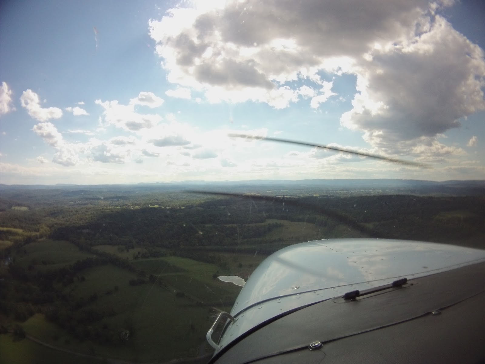
The plan was to sit right seat and log PIC time while Woody got some simulated instrument time on a cross country flight around central Virginia.  The original plan was to fly from Potomac Airfield (VKX) to Louisa County (LKU), Lake Anna (7W4), Chesterfield (FCI), Williamsburg (JGG), and then back to VKX.  The last renters left the plane at Maryland Airport (2W5) the night before, though, so the departure point had to change.  Luckily, that airport is outside the Flight Restricted Zone (FRZ), so we didn't have to deal with that nonsense.  Once we got to the airport, Woody changed the plan to 2W5, Gordonsville (GVE), LKU, 7W4, Newport News (PHF), and then back to 2W5.  I had no objections, so I jumped in, set the ContourGPS in the mount, the Garmin GLO up on the glareshield, and the iPad in my lap.

I tried something slightly new this time since I had both cameras.  Yes, both.  You haven't been formally introduced to the new one, but if you were paying attention to my post about my new pilot bag, I briefly mentioned it.  I used the ContourGPS for the time lapse portions, and the new ContourROAM for videos of takeoff and landing.  Thinking back on it, I should've reversed that, but you know what they say about hindsight...

First Leg: 2W5-GVE - 0.8 hours

Say what you want about the random music.  I figured something needed to be done for the completely silent cruise portion.

As I was mainly along for the ride as a safety pilot, Woody was at the controls for the departure.  I only briefly took the controls so that he could put the blinders on.  For not having flown under the hood in what he said was a while, he did a good job, especially with a directional gyro that precessed terribly.  For the non-pilots, the directional gyro is like a compass, but without some of the errors present in magnetic compasses.  The problem of the gyro is that over time it precesses, which essentially means it drifts away from the real heading, so you have to update it by comparing it to the magnetic compass.  It's really not as complicated as it sounds, but it's something we have to pay attention to.  As we got closer to GVE, I "vectored" Woody towards the runway.  After he took off the blinders, he set the plane down on GVE's short, less-than-level runway.  Arriving at the ramp, he shut the plane down and we jumped out to get our Virginia Aviation Passports stamped (the same type of passport used as an excuse for a flight down to Richmond in February).  The stamps for smaller fields like GVE are normally kept in a mailbox, but in searching for said mailbox we ran across an airport building halfway through a renovation, and a giant garden spider (the black and yellow ones that make webs with zig-zags in them...you know...those).

After getting the stamp, we jumped back in the plane to head to LKU, which is close to Lake Anna.

Second Leg: GVE-LKU - 0.3 hours


The flight over to LKU was slightly more eventful.  As anyone who reads the blog regularly knows, I end up doing at least one short-field takeoff on most flights.  Half of it is because I find them to be fun, and the other half is that you never know when you'll need to do one.  Well, today we needed one.  GVE's runway is only 2300 feet long, it dips in the middle with trees close to the ends, and we were in a P model with two heavier guys in it.  I've taken off from shorter, but not with that combination of issues.  It wasn't my best short field takeoff, but I'll blame it on having to fly from the right seat, which I've done before, but I don't do it often.

The fun didn't end there, though.  After takeoff Woody put the blinders on, took the controls, and put us on course to LKU.  As we were climbing, I noticed a Piper opposite direction, about 500 feet above us (01:45 in the video - the wide angle lens on the camera makes it seem farther away than it was).  It caught me a little by surprise, so I reached forward and put pressure on the yoke to halt the climb temporarily.  As soon as they passed, Woody continued the climb.  Closer to LKU, Woody brought us around the pattern and set down.  We parked by the main airport building, which had an attached hangar with a Civil Air Patrol glider in it.  After walking inside, I spotted the passport stamp sitting on a counter, so I grabbed my stamp, walked back out to the plane, and grabbed a picture.

Next up was 7W4.

Third Leg: LKU-7W4 - 0.3 hours


The departure from LKU was relatively simple compared to GVE.  The runway is nearly twice as long and two and a half times as wide, so it was nice and easy.  Just like the last leg, though, it was pretty short, time-wise.  Still, Woody was able to pick up some time with the blinders.  Things got interesting as we got closer to 7W4, however.  Because the ramp is at the east end of the runway, pilots like to save time by departing to the west, and arriving to the east.  As I switched the radio to the airport frequency, I heard a pilot call and say he was departing Runway 26.  So, just like the approach to LKU, we would make our way around the pattern to land west.  What I didn't hear, however, was a second plane make a call to indicate he was taking off behind the first plane.  It wasn't an issue, but it surprised me when I saw two bright yellow crop dusters rise off the runway and turn north.  The landing was uneventful, but it wouldn't be the last time we saw those crop dusters, or the last time they would surprise us.

Woody rolled out to the end of the runway, where we turned around and taxied back to the east end to shut down and search for the stamp.  While he made a call ahead to Atlantic Aviation at PHF to reserve a crew car, I found the mailbox and stamped both of our passports.

Fourth Leg: 7W4-PHF - 0.9 hours


As I mentioned earlier, that wouldn't be the last time we'd see, or be surprised by those crop dusters.  This time, the surprise made the Piper incident earlier pale in comparison.  As Woody was running preflight checks, I monitored the airport frequency.  When we were ready, I called to announce the westbound departure, which was what the flow of traffic was: the two crop dusters departed to the west, and we landed to the west.  After the call, however, one of the dusters called and said they'd remain clear and circle away from the airport, because they wanted to land to the east (to save time, as mentioned earlier).  I took his word for it, though I did check the pattern legs quickly to be sure.  While we were rolling down the runway, I spotted one of them crossing our departure path, north to south, rolling to make a knife-edge pass and turn westbound.  I called the traffic out to Woody, who turned north to avoid turning towards him.  Since I remembered the duster had a buddy who wasn't making radio calls, I searched ahead of our turn and spotted him at the same altitude (both of them had been down on the treeline) to the east of the field.  You can just barely make them out in the video.  As I mentioned with the Piper, the wide-angle lens makes them appear farther away.  If you can't see them, use full screen and 1080p.  The annotations help to mark where they appear a few seconds ahead of time.

Once we were clear of that mess, I switched to Potomac Approach to coordinate getting over to PHF.  In order to take the most direct route, we would fly through Richmond's Class C airspace, so we were required to be in contact with them.  We passed the cruise time by discussing the ATC hiring process, and the overall poor quality of the pilots that Potomac had to deal with.  A couple pilots either weren't paying attention or just had a poor grasp of English, which we found entertaining.  The controller, not so much.

Closer to PHF, we passed over Busch Gardens on the way to land on Runway 20.  Since we couldn't spot the Lear landing on the crossing runway, tower had to ask us to do just about everything possible to delay our arrival, to include entering on a 6 mile final, s-turns, and a tight 360 turn on short final.  You'll see all of it in the video.  What you can't see, however, are the training aircraft that were on the ramp for ATAC, which is a firm that provides training for military pilots by flying aggressor or foreign aircraft to show the pilots the capability of their potential enemies.

We parked at Atlantic as an AirTran 737-700 prepared to depart.  Woody grabbed the car, and we sped off to get burgers at Red Robin.  As we were sitting at lunch waiting for our food, we pulled up the weather to see if anything had changed.  Of course, more storms were going to be passing through as part of another frontal system, similar to the ones last night.  The mutual debate continued when we got back to Atlantic.  After a call to a flight briefer, we decided it would be best to at least move in the direction of home, and if necessary, land to avoid an approaching storm.  This being the strategy, we identified both West Point (FYJ) and Tappahannock (XSA) as bailout points.  If you look at the image to the right, you'll see that the band of storms to the south would have arrived much later, while the storms to the north would pass through much sooner.  Had we waited for the northern storms to pass, we would have had to try to beat the southern storms out.  By departing earlier and stopping in XSA, we cut the wait time for the northern storms and avoided having to try to beat the southern storms out.  I point that out mostly to clarify that there was a definite plan to the idea, and not simply "let's see how far we can get before the storms get here."

Getting ready to head home
Fifth Leg: PHF-XSA - 0.8 hours


Tower sent us out right behind another aircraft that would remain in the pattern.  By this point, Woody was getting slightly tired of flying, so he passed the controls over to me after turning crosswind.  In an effort to continue to let us both log time, I put the blinders on.  Woody called Potomac for route guidance, and limited weather info since the storms were clearly visible to the north.  As we flew over FYJ, we heard "Cessna 64181, do you have weather radar on board?"  The controller's tone conveyed both concern and surprise that a small plane would be out braving the weather.  We took the hint and turned northwest bound to skirt the back end of a storm and land at XSA.  I didn't mess with the camera as I was flying, which is why you have a time lapse approach and landing.  There are a few cool shots of the weather as we passed by it, though.

It took us a minute to find XSA, as there weren't many identifiable landmarks around it, which you can see in the video, but we made it in the end.  The red-roofed terminal building made it easy to spot once we got closer.  After landing, I brought the plane back to the ramp, parked it, and we both tied it down in preparation for the storms.  Inside, one of the airport attendants and a local Virginia State Trooper kept us company while we reviewed the weather and developed a new plan of attack.  Luckily, some of the storms had dissipated, and the storm that was supposed to pass over XSA passed well north.  Because of that, we were able to leave slightly earlier than we had thought.

I grabbed a drink, and we set off for 2W5 after Woody filed an SFRA flight plan.

Sixth Leg: XSA-2W5 - 0.6 hours


I ended up flying the whole leg to 2W5 from XSA, getting more time under the blinders.  Unfortunately, the camera died on the way there, despite my efforts to charge it at PHF and XSA.  What you see for the landing video was shot from the ContourROAM up in the mount.  I cut the base turn a little early so I ended up high and fast down final.  I salvaged it by I bleeding speed over the runway.  The landing was flat, but it wasn't too bad in my book.  After the taxi back, I parked the plane at the grass tie downs and helped prepare the plane for its overnight stay.


In the end, we both logged about 3.7 hours, each getting a good amount of time under the blinders.  I got 0.8 hours of simulated instrument time, which definitely helps towards the instrument rating.  This trip also gave new meanings to the term safety pilot, as this was the first time I ever flew safety for someone and actually had to call traffic to avoid a collision.  Later on, we both learned the importance of a safety pilot for weather avoidance as well.  Despite the traffic issues and the added stress of the weather, I really enjoyed the challenge of the whole trip.

When you're required to have a safety pilot, always make sure you have one, and a helpful one at that.  A safety pilot isn't there to be a conversationalist to help pass the time, either.  He or she is there to keep you out of trouble.  I'm not saying the flight should occur in complete silence unless there's a conflict, but don't bring along your pilot buddy who can't keep their eyes out, or one who shows poor decision making skills.

Beyond that, always remember your tolerances.  In ground school, you always hear people say "personal minimums," but I like the term tolerance.  How much risk are you willing or capable of tolerating?  To some people, the radar image shown above would have kept them on the ground, and I wouldn't blame them.  Given the information I had, and the additional safe spots for landing, my risk tolerance was slightly higher because I knew I had options in case the risk became too great.

Every time you put the aircraft in the air, you're accepting risk.  How much risk you tolerate is up to you.  If you are willing to fly with a higher tolerance, just make sure you cover as many bases as possible to remain safe when that tolerance is reached.  Flying VFR doesn't mean you shouldn't have alternates, both in the form of airports, and in the general form of other options.

Hours:
Pilot in Command Cross Country (PIC XC): 3.7 - 70.5 (of 50)
Actual/Simulated Instrument (Act/Sim): 0.8 - 8.3 (of 40)

23 September 2012

Review: ForeFlight, iPad and GLO

For those who don't want the details, here's a quick summary:

iPad with ForeFlight:
One of the best investments you'll ever make for flying.  It's capable, quick, allows you to select which charts and maps to cache so that you don't take up space with ones you don't use, stores aircraft you fly, and will even brief and file for you through CSC DUATS.  The only slight downside is that if your iPad is the wireless-only version, you'll need an external GPS receiver like the Garmin GLO for aviation, below.

Criticism: The version 4.7 update seems to have deleted the Starred Airports list (yet you can still star them on the airport pages).  It would be nice to have that back.  It's not a huge deal, though.
Update: They fixed this in the last update (4.7.2), which I just downloaded 27.Sep.12 at 2015EDT.

Costs:
iPad - $499-699
ForeFlight - $74.95 per year (or $149.99 for geo-referenced approach plates)
Optional: Stratus ADS-B - $799


Garmin GLO for Aviation:
It's basically the normal Garmin GLO with a few extra accessories, which includes a non-slip pad which clings to anything so you don't have to worry about mounting it, or having it slide around during the flight.  It boots quickly, locates satellites quickly, and is really easy to connect via Bluetooth.  Worth every penny.

Criticism:  None from me, but some have reported issues with satellite reception with heated windscreens.  Others say it's too easy to bump the power button and turn it on accidentally, but a little care in placing it in your flight bag solves that issue.

Costs:
Garmin GLO for Aviation - $120


The Full Review: ForeFlight, iPad and GLO


As technology gets more and more convenient, powerful, and compact, it starts to branch out into more and more of our lives.  If you asked me if I'd ever use a touchscreen half-laptop to view charts back when I started flying, my response would have been "yeah, eventually, but not any time soon."

It wasn't until 2010 that the first generation iPad came out, and even then the idea that you could use it for that purpose was still just a dream.  It's crazy to me that the iPad was released just over two years ago, yet it has already come quite a long way.  I jumped at the opportunity to get one earlier this year and ended up putting ForeFlight on that night.  I'm no Apple fanatic, but I have to admit that at least two of their products have revolutionized my life, and this is one of them (the other being the iPod).

Note the "No Fix"
I had originally gotten the iPad for work so that I could read and review documents at client sites when I wasn't allowed network access.  Since I'd be primarily using it where 3G data wouldn't be an option either, I opted for the wireless version.  When I tried to use ForeFlight in ground tests, I found out very quickly that the wireless version does not come with a GPS receiver like those equipped for 3G connections.  The lack of a GPS receiver in the wireless model isn't a secret to the industry, though, so there are a few products out there to feed all iPads with GPS data at somewhat reasonable prices.  While that was an unfortunate discovery, it didn't hit as hard as it would've if I'd bought the iPad specifically to be an electronic flight bag (EFB).


Even without the GPS function to show you exactly where you are in map view, the app is really great for not having to bother with the paper charts*.  Granted, I believe that you should still have some with you, but you don't have to worry about flipping or folding anything and punching your passenger or pilot buddy in the face while using the iPad.  The charts may also be cached at your discretion, in order to avoid wasting memory space that you could be using for in-flight audio.  Those caching selections are stored, so ForeFlight will only update those maps you've essentially subscribed to.  Furthermore, it will cache anything you view until it expires if it's not part of your normal selections.  As an example, I don't fly around Los Angeles so I don't cache the area through my settings.  If I browsed LAX's departures and arrivals, however, those charts will be cached until the next chart update.  It's not particularly useful for my regular flying, but it's a nifty feature to store single charts here and there when you fly commercially and want to follow along.

Beyond simply displaying various charts, ForeFlight also allows you to create chart binders so that you don't need to mess around with the airport information pages to see the relevant charts.  If I were to fly IFR from Leesburg (JYO) to Blacksburg (BCB), I could create a new binder with all of the charts necessary for those two airports, and perhaps an alternate or two.  If you fly the same routes often, you can save the binders and switch between them as necessary.  As you can see in the picture, I created a binder with the approaches I plan on flying during my long instrument cross country flight.  I have three different binders for the flight in the case weather messes with the plan, or if I have to change into an aircraft with different equipment.

In addition to chart binders, it also allows you to store various documents from the ForeFlight library.  This also has a binder feature like the charts so that you may group your documents.  In my case, I have a binder for A/FD supplementals, various books, and the chart legends.  In the binder with various books, I have all of the books they had available, including a copy of the AIM, Instrument Procedures Handbook, and the Pilot/Controller Glossary.  So, if you're in the middle of a flight and there's a disagreement on the proper way to enter and exit a traffic pattern, the pilot not flying can pull up the AIM and settle it on the spot.  Oddly enough, the FARs aren't in the library.


Weather is, of course, important to keep on top of both before and during your flight, and ForeFlight is just as capable there as any of the weather sources you may frequent.  Graphical AIRMETs, SIGMETs, turbulence, icing, Doppler radar loops, outlooks and significant weather outlooks, PIREPs, prog charts, satellite imagery and winds aloft are all at your fingertips.  Limited data is also available for Mexico and Canada.  If you're looking for weather during your flight, you can always enable the weather overlays in map view with the Stratus ADS-B receiver, which costs a pretty penny, but has some nice capabilities.  If you fly in the mid-west, though, make sure to check the coverage map as ADS-B receivers haven't fully covered the country.


Closer to departure, you can brief yourself and file your flight plan using your CSC DUATS account, which you add in on the Settings page of the app.  The File & Brief page allows you to view a history of your flight plans as well, so you don't have to create a new one every time.  Additionally, you can store the aircraft that you fly to make the filing easier.  When you add the aircraft, drop down boxes guide you through the process of selecting equipment codes, default altitudes, and even generating the aircraft color codes.  At the bottom right of the page, you can see both brief and file buttons, which will get you on your way.


The Scratchpad is a quick way to jot down information like frequency changes, clearances and so on.  I've found that it's best used with a stylus, but your finger will work almost as well.  There's a button at the top right that allows you to adjust the size of the text as you draw.  The picture shows the finest setting.  When it's bumpy, I normally revert to using the plane as my scratchpad (when I have a radio with a standby slot), or pen and paper.  There is also an option that allows you to type, if you'd prefer that.  Just keep in mind that the iPad's spellcheck isn't up to date with aviation shorthand.  It isn't perfect, and I liken it to writing on a whiteboard as you can't rest your hand on the writing area when writing, but it gets the job done.  The only other downside I can think of is that in order to erase, you have to clear the whole screen.  For the quick notes you'd be writing in the air, though, you don't necessarily need it to be pretty, so it's not a huge deal.


When it comes to plotting your flight plan on the maps, ForeFlight is capable of more than just airports, navaids, and fixes.  Airways are also understood so you can save time by entering the plan just as you would in your filed plan.  Beyond that, there are a few other features that will help you choose altitudes based on observed winds aloft, and see your estimated fuel burn and time en-route.  The NavLog will also break it down leg by leg, if you need the extra detail.  When it comes to overlays, you have options for radar, satellite, TFRs, AIRMETs, SIGMETs, flight rule indicators for the airports, airport temperatures, airport temp/dewpoint spreads, visibility, wind, ceiling, sky coverage, PIREPs, lightning, and fuel prices for both Jet-A and avgas.  The bottom panel also has four buttons that can display groundspeed, GPS altitude, track, signal accuracy, ETE to next, ETA to next, distance to next, bearing to next, cross track error, ETE to destination, ETA to destination, distance to destination, bearing to destination, current lat/lon, or Zulu time.  The amount of information at your fingertips is nearly endless.


Here are a few more screenshots of the ForeFlight interface:


The left screen is the altitude selection page.  Note the inclusion of the wind data to help you in your selection.  The right screen is the settings page, where you can set default units, among other options.  You can even change the position symbol on the map from a high wing, low wing, jet, fighter, or helicopter.


As mentioned earlier, for those of you who don't have your iPad on a 3G data plan, you don't have the built in GPS receiver and will have to get an external receiver.  There are a few different units out there, with the more notable ones being the Dual, Bad Elf, and Garmin units.  I ended up getting the Garmin GLO for Aviation because it was about the same price as the Dual and came with the accessories that I expected I'd need.  The non-slip pad clings to just about anything.  You can see I have it on wood in the picture at right, but even on that surface I have to pick it up by the corner, otherwise it stays suctioned in place.  The steady blue light means it's connected to the iPad via Bluetooth, and the steady green means it has picked up the required number of GPS satellites.  The button where the green light is serves as the power switch, and is the only button on the device.  In front of that is a USB port to charge the device.  After opening the box, turn it on, enable Bluetooth on your iPad, look for "Garmin GLO" in the list, and select it.  Done.  It's really that simple.


The whole setup really makes working in the cramped space of most smaller planes a breeze.  It also helps add in some situational awareness when compared to following along on a paper chart, or even certain moving-map GPS units.  If you're looking at the various EFBs available on the market, you should definitely consider it.  Some of the other EFBs are aimed more at the corporate setting, which you can see in the way they structure their pricing.  I'm not saying that they aren't useful to the GA pilot, rather I'm just attempting to point out that the target market might not be you in all cases.  Jepp does have their own version using Jepp charts instead of NACO for a comparable $76, and is aimed at the private and corporate pilot group.  Most of them have trial periods as well, so you don't have to worry about risking anything until you try it and like it.

Hopefully this helped you in your decision.  If you have questions, the best spot is the blog twitter account @TheLifeOfAPilot.


*A note on charts: it's a common misconception in many pilot circles that charts are required any time you fly.  Charts are only required when flying large or turbojet aircraft, or when flying Parts 121 or 135.  The official FAA stance may be found here.  While I don't condone flying without charts, I wanted to point out that you wouldn't be breaking regs by dispensing with paper charts.

18 September 2012

Review: Redefining Pilot Bag

I've been asking people what they think of the blog, and some of the comments I got were that it could use a more "bloggy" feel with regular updates and commentary on other things besides flight narratives.  I've definitely added a couple non-flight posts, but I see exactly where they're coming from.  That feedback was right in time, too, since I just got a few new items I figured I'd review here.  The first in that line of reviews is my new pilot bag from Timbuk2.


Since I got my pilot bag back in 2003, I always had some sort of trouble fitting everything I need in there.  Granted, I carry lots of stuff, but it's all mostly useful.  Some may roll their eyes at that since I probably have four or five flashlights in there, but there's a lot to carry.  Just off the top of my head, I know there's an iPad, a kneeboard, a notepad, an E6B, a plotter, a sectional chart, a terminal area chart, instrument approach procedures, the ContourGPS, the ContourROAM, accessories and mounts for the two cameras, a Garmin GLO, and the assorted flashlights.  I'll admit, for a bag that was aimed at the student pilot, it holds its own, but I've outgrown it.

There are certainly other, larger bags available from places like Sporty's, but I figured I'd break the mold slightly.  I ended up getting a Timbuk2 messenger bag because they can haul all kinds of things, and are versatile enough to carry what I need for flights.  All of the extras pilot bag makers wouldn't really think of (the cameras and other electronics) fit with ease, as well.  The bag I actually ordered is a large custom laptop messenger, which means it has a padded sleeve built in for a laptop, in addition to a padded pocket for an iPad.  You can see it near the back with a red lining in the picture.  That will fit my 17" laptop, and the iPad is in front of that.  Beyond that, there's a cavernous space to put whatever else you need in there, with a few other pockets to organize various other things like pens, phones, and keys.

On the two flights I've taken it on, it's proven a lot easier to work with.  It's not standard by any means, but it certainly fits everything I need it to with ease.  If you're looking for a bag, it might be worth a look if you're not bent on buying an actual pilot bag.  Most of the bags are customizable, as well, so you can change the colors, and comfort options to fit your personal taste.  I can definitely say it's a lot more comfortable to lug around.


I'd say that spread speaks for itself.

09 September 2012

More Comfort Food in Charlottesville

N5294W - C172R - 1.7 hours

Clouds west of JYO
The other night, I was hanging out with my friends Christina and Brittany and the idea of flying this weekend came up.  No plans were set in stone, so when the idea came back up I was somewhat surprised.  At first, since the flight would be between lunch and dinner, I figured we'd just fly down to Luray (W45) and back.  As the time came to head up to the airport, I changed my mind and decided and Charlottesville (CHO) because I needed food, and you all know what my go-to is by now.  Just like last time, the plan was to head to Timberwood Grill.  I've been there all too much over the past year, so I'm going to go on the record and say that trips to CHO are going to be drastically reduced for a little while.  I feel like I'm missing out on a lot of other destinations.

Sorry Timberwood - I still love you.

On to the narrative.

After getting to the airport, Christina, Brittany and I grabbed the flight book and headsets, and walked out to the plane in weather that I'd consider to be just about perfect.  After the preflight, they both climbed in the back while I set up my Garmin GLO GPS (which I just got in the mail on Thursday - I'll review it with ForeFlight eventually), ContourGPS, and the rest the technology.

The taxi out took a longer amount of time than normal because the nice weather brought everyone out.  Whereas there are normally only one or two people ahead of me, I ended up heaving two departures and two arrivals ahead of me by the time I finished my engine run up.  Once they had all done their thing, I was able to get up and out.  I got a video of the departure, but it was just downright ugly with the wind that had picked up so I didn't upload it.  This being Brittany's second flight ever - not just in small planes - the bumps weren't appreciated.  Reaching cruise, though, the bumps smoothed out.

Yes, this is the big EMB-145
Getting closer to CHO, I called the tower and was instructed to call back when I reached the downwind for Runway 3.  As I entered the downwind, a Piedmont (regional carrier for US Airways) Dash 8 called in and was cleared to land ahead of me.  I turned in behind it, landed, caught the first exit and brought it in to the Landmark ramp.  I had the Contour running the whole flight, but I didn't upload any of it because nothing truly interesting happened (and I'll admit the landing wasn't the best, either).  After parking, an American Eagle (regional carrier for American) Embraer 145 taxied out to the runway, prompting Brittany to comment that "it's so BIG!"

As usual, I was greeted with "you gonna want the crew car?"  As much as I like being recognized, this is more evidence that I need a break from CHO.  In an effort to break the norm in some way, I actually switched it up at dinner and got an Al Capone burger.

ForeFlight running with a Garmin GLO
and iPod on the aux input
On the way back, I spent a little more time testing ForeFlight, while we listened to my iPod through the aux cable I bought a while back.  For those who are wondering how that works since pilots need to listen for other pilots and air traffic control, the aux input is overridden any time someone speaks, either in the aircraft or over the frequency.  That ends up making listening to music frustrating at times, but it's worth it for longer flights, especially at night.  Having GPS input on ForeFlight really makes it that much more worth it, as well.  Now, every plane I fly essentially has a moving map GPS.  Granted, I can't shoot approaches with it, but it really helps.

As we got closer to Leesburg, the bumps picked back up as a result of the wind having increased and the lower altitude.  The JYO traffic frequency was really busy with one in the pattern, a MedFlight helicopter inbound, and two other aircraft approaching from the north.  The two approaching from the north had apparently gotten really close to each other, and there was an interesting exchange between the pilots that clogged up the frequency for a while.  I compensated by making my calls really short, but I still ended up getting stepped on a couple times by the other pilots.  Despite all of the radio traffic, I managed to get in during a break in the traffic.

You'd think that it was easy from then on, but it wasn't.  The wind really messed with me, with gusts making it difficult to hold a proper speed down to the runway (which you can definitely see in the graph to the right of the video below).

Enjoy said video of me getting my butt kicked all the way down final:

[Video was here until Contour closed down for a bit, and the video was lost.]

Didn't expect that greaser of a landing at the end, did you?

Hours:
Pilot in Command Cross Country (PIC XC): 1.7 - 66.8 (of 50)
Actual/Simulated Instrument (Act/Sim): 0.0 - 7.5 (of 40)